Enters state: FromVirginia, Berkeley County, south of Martinsburg.
Leaves state: Into Maryland, Berkeley County, north ofMartinsburg.
Counties: Berkeley.
Major Cities & Towns: Martinsburg.
Comments: US 11 parallels I-81 for most of that interstate'sTennessee to New York run, and West Virginia is no exception. Thetwin routes cut through the state's eastern panhandle.
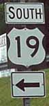
Enters state: FromVirginia, Mercer County, at Bluefield.
Leaves state: Into Pennsylvania, Monongalia County, north ofMorgantown.
Counties: Mercer, Raleigh, Fayette, Nicholas, Braxton, Lewis,Harrison, Marion, Monongalia.
Major Cities & Towns: Bluefield, Princeton, Beckley, OakHill, Fayetteville, Summersville, Weston, Clarksburg, Fairmont,Morgantown.
Comments: For the most part, US 19's status as a thru routehas been supplanted by I-77 (between Princeton and Beckley) and I-79(between Flatwoods and the Pennsylvania state line). However, twoseparate sections of US 19 are Appalachian Regional Commissioncorridors. Between Bluefield and Princeton, US 19 shares a route withUS 460, Corridor Q. And between I-77 and I-79, US 19 is Corridor L,which serves as a shortcut for thru traffic using the 77-to-79corridor and allowing drivers to avoid several miles (and two WestVirginia Turnpike toll plazes) on their route. US 19 crosses over thefamous New River Gorge bridge north of Fayetteville. Summersville,which is near the halfway point along the corridor, is a notoriousspeedtrap and motorists are cautioned to stick to the posted speedlimit. Corridor L runs into I-79 southwest of Sutton; US 19 is routedonto the interstate at the end of the corridor and exits onto itsoriginal alignment at Flatwoods.
Begins: At I-64 andI-77 (West Virginia Turnpike), Raleigh County, north of Beckley.
Ends: At US 19/WV 16, Raleigh County, north of Beckley.
Counties: Raleigh.
Comments: This route is the part of Corridor L that links US19 with the West Virginia Turnpike. It is also known as Alt. US 19,but is signed as To US 19 North from the interstate or To I-64/I-77from US 19. Motorists exiting from the northbound turnpike orentering the turnpike southbound are charged a toll.
Begins: At US 250,Marion County, at Fairmont
Ends: At US 19, Marion County, at Fairmont.
Counties: Marion.
Comments: This is a connector route in Fairmont and is notsigned.
Enters state: FromOhio, Brooke County, at Weirton.
Leaves state: Into Pennsylvania, Brooke County, atWeirton.
Counties: Brooke, Hancock.
Major Cities & Towns: Weirton.
Comments: This route is now a full freeway from west ofSteubenville, Ohio, through the northern panhandle of West Virginiaand on to the outskirts of Pittsburgh. In West Virginia, it entersHancock County for only a brief instance before returning to BrookeCounty.
Begins: At US 22,Brooke County, at Weirton.
Ends: At US 22, Brooke County, at Weirton.
Counties: Brooke.
Comments: A surface street in Weirton ñ possibly theoriginal alignment of US 22 before the freeway was built ñ andnot signed.
US30
Enters state: FromOhio, Hancock County, at Chester.
Leaves state: Into Pennsylvania, Hancock County, east ofChester.
Counties. Hancock.
Major Cities & Towns: Chester.
Comments: West Virginia's shortest US route cuts through theextreme northern part of the state on a southeasterlyangle.
.jpg)
Enters state: FromOhio, Mason County, at Mason.
Leaves state: Into Virginia, Pendleton County, east ofFranklin.
Counties: Mason, Jackson, Roane, Calhoun, Gilmer, Lewis,Upshur, Barbour, Randolph, Pendleton.
Major Cities & Towns: Ripley, Spencer, Glenville, Weston,Buckhannon, Elkins, Franklin.
Comments: Although odd-numbered US routes are supposed to benorth-south highways ñ and US 33 does nominally run from south(Richmond, Va.) to north (Indiana) ñ it is signed as aneast-west route. After entering the state, it parallels the OhioRiver, including a brief stretch where it shares an alignment with WV2, before it turns away from the river. It cuts through hilly terrainin the central part of the state, passing through small towns andrural areas and carrying US 119 for much of the way. At Weston, theroute picks up the ARC Corridor H designation at the I-79 interchangeand is a four-lane road to Elkins, where the Corridor H alignmentdeparts the highway. East of Elkins, the route climbs the mountainsin one of the most scenic parts of the state, passing near SpruceKnob (the state's highest point) and the oft-photographed SenecaRocks. US 33 passes through the Monongahela and George Washingtonnational forests before crossing into Virginia at the crest ofShenandoah Mountain. The mountain crossings are crooked and slow,although most of them have truck climbing lanes to allow fasterpassenger vehicles to pass the many slow trucks which use theroute.
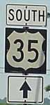
Begins:At US 60, Kanawha County, at St. Albans.
Leaves state: Into Ohio, Mason County, just outside Pt.Pleasant.
Counties: Kanawha, Putnam, Mason.
Major Cities & Towns: St. Albans, Winfield, Pt.Pleasant.
Comments: US 35 is signed as an east-west route in Ohio, butas a north-south route in West Virginia and Indiana. It currently hasthe distinction of being the only US route that terminates in WestVirginia. Prior to the collapse of the Silver Bridge linking Pt.Pleasant to Gallipolis, Ohio, in 1967, US 35 ran along what is now WV25 and US 62. It began at an intersection with the former US 21 andUS 60 in Charleston and ran along the east side of the Kanawha River.The new Ohio River bridge built to replace the Silver Bridge waslocated downstream of the mouth of the Kanawha. When the bridgeopened, US 35 was routed along the former WV 17. This route isheavily traveled, especially by trucks, and is part of a thru routefrom Charleston to Cincinnati, Dayton and Columbus. The Ohio Rivercrossing and a few miles of the highway near Henderson are fourlanes; and the West Virginia Department of Transportation has plansto build a new four-lane US 35. The new route will tie into I-64between exits 39 and 44 and will generally follow the route of WV 34from Teays Valley to Winfield, and then US 35 on to the Ohio Rivercrossing.
Enters state: FromOhio, Ohio County, at Wheeling.
Leaves state: Into Pennsylvania, Ohio County, east ofWheeling.
Counties: Ohio.
Major Cities & Towns: Wheeling.
Comments: The old National Road parallels I-70 for most of itstrek across the country, and the northern panhandle of West Virginiais no exception.
US 48(Proposed Route)
Will begin: At I-79,Lewis County, east of Weston.
Will leave state: Into Virginia, Hardy County, east ofWardensville.
Counties: Lewis, Upshur, Barbour, Randolph, Tucker, Grant,Hardy.
Major Cities & Towns: Buckhannon, Elkins, Parsons.
Comments: Until recently, US 48 existed only on paper as thenumber to be given to the controversial ARC Corridor H route once thehighway is completed. In the spring of 2003, Virginia posted US 48signs along the VA 55 portion of the proposed corridor ñ thisdespite the fact that Virginia does not as yet have plans to buildits portion of the highway. Corridor H will follow the existingfour-lane route of US 33 from I-79 near Weston to Elkins, then willapproximately follow the route of US 219 from Elkins to Thomas and WV93 from Thomas to Scherr, then follow a new route from Scherr to OldFields (where it will cross US 220) then follow WV 55 from a pointeast of Moorefield into Virginia. Construction on Corridor H has beenplagued with lawsuits, to the point where the only portions openbetween Elkins and the state line are a short stretch from Elkins toKerens, and another short stretch from east of Moorefield to Baker.This will be the second incarnation of US 48 in West Virginia. The US48 designation was originally given to ARC Corridor E, but thathighway now carries the I-68 designation.
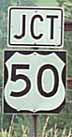
Enters state: FromOhio, Wood County, at Parkersburg.
Leaves state: Into Maryland, Preston County, west of Redhouse.Md.
Re-enters state: From Maryland, Grant County, at Gormania.
Leaves state: Into Virginia, Hampshire County, east of CaponBridge.
Counties: Wood, Ritchie, Doddridge, Harrison, Taylor, Preston,(Maryland), Grant, Mineral, Hampshire.
Major Cities & Towns: Parkersburg, Clarksburg, Grafton,Romney.
Comments: The portion of US 50 from the Ohio River to I-79 atClarksburg is part of ARC Corridor D, which runs all the way fromCincinnati to Clarksburg. The corridor is not complete in theParkersburg area, but plans are underway to build a new Ohio Riverbridge and link the four-lane sections in Ohio and West Virginia.East of I-79, the route runs through a rural area, crosses brieflyinto Maryland, and re-emerges in the eastern panhandle.
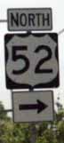
Enters state: FromVirginia, Mercer County, near Bluefield
Leaves state: Into Ohio, Cabell County, at Huntington.
Counties: Mercer, McDowell, Wyoming, Logan, Mingo, Wayne,Cabell.
Major Cities & Towns: Bluefield, Welch, Williamson,Huntington.
Comments: US 52 is signed as a north-south route in WestVirginia and points south, but is signed as an east-west route inOhio and most other states to the north and west. It passes mainlythrough the coalfields of southwest West Virginia before runningalong the Big Sandy River to the Huntington area. The route entersWest Virginia on I-77's route, briefly joins US 460 (ARC Corridor Q)and US 19 in Bluefield before turning west toward Iaeger and thennorthwest toward Williamson. At Williamson, the route joins US 119(ARC Corridor G) and actually crosses the river into Kentucky twice,returning to Mingo County each time. Once US 119 leaves the highway,US 52 continues northward. North of Crum, the highway is generally ona new alignment dating back to the late 1970s, paralleling the riverand the Kentucky border. (The old alignment of US 52 is now known asWV 152 and WV 527.) It joins I-64 before using the West HuntingtonBridge to exit the state into Ohio. The state plans to completelyrebuild US 52 as part of the ìI-73/I-74î corridor thatactually will not be an interstate highway at all, but instead willhave at-grade intersections. Currently, the only portions completedare the interchange with US 460 at Bluefield, a bypass of Prichard inWayne County, and another section in Wayne County between WV 75 andI-64.
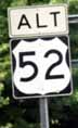
Begins: At US 52,McDowell County, east of Welch.
Ends: At US 52, WV 16 and WV 103, west of Welch.
Counties: McDowell
Major Cities & Towns: Welch
Comments: This is the old route of US 52 through downtownWelch. The current, newer alignment of US 52 winds along the side ofthe mountain on the south side of town. This route continues straightinto downtown Welch, then runs concurrently with WV 16 to theintersection of US 52, WV 16 and WV 103. Is signed as Alt. US 52 onlyat the western end, and there only as a reassurancemarker.
Enters state: FromKentucky, Wayne County, at Kenova.
Leaves state: Into Virginia, Greenbrier County, east of WhiteSulphur Springs.
Counties: Wayne, Cabell, Putnam, Kanawha, Fayette,Greenbrier.
Major Cities & Towns: Huntington, Barboursville, SouthCharleston, Charleston, Lewisburg.
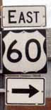
Comments: The fabled Midland Trail, US 60 cuts through themountainous heart of the state after linking the metropolitan areasof Huntington and Charleston, the urbanized area between the twocities, and the industrial Kanawha River valley. US 60 parallels I-64closely from the time it enters the state from Kentucky to well pastCharleston. The route is four lanes outside Charleston to the CedarGrove area, and parallels the Kanawha to Gauley Bridge, where theGauley and New rivers merge to form the Kanawha. From there, thehighway cuts across the mountains until it rejoins the I-64 corridorat Sam Black Church. Before the completion of I-64 from Sam BlackChurch to Beckley in the late 1980s, thru traffic along theinterstate corridor had to use US 60. From I64's Exit 156 east to theVirginia state line, US 60 again parallels the interstate.
Enters state: FromKentucky, Mingo County, at Williamson.
Leaves state: Into Pennsylvania, Monongalia County, north ofMorgantown.
Counties: Mingo, Logan, Boone, Lincoln, Kanawha, Roane, Calhoun,Gilmer, Lewis, Upshur, Barbour, Taylor, Monongalia.
Major Cities & Towns: Williamson, Logan, Charleston,Spencer, Glenville, Weston, Buckhannon, Grafton, Morgantown.
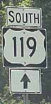
Comments: Slicing a diagonal route from southwest tonortheast, US 119 covers all spectrums of the West Virginia highwaysystem. From a high-speed four-lane route to a winding country road;from a major through highway to a route supplanted by the interstatesystem, this route represents it all. From its entry into the statefrom Kentucky to Charleston, the route carries ARC Corridor G. Itpicks up US 52 immediately after entering West Virginia, and the twocosigned routes actually cross back into Kentucky twice beforesplitting near Nolan. US 119 angles northeastward through thecoalfields before running into I-64 at Charleston. Once out of thecapital city, the route parallels I-79 for a distance before turningnorth, joining US 33 at Spencer. At Weston, the routes becomeCorridor H once the cross I-79. US 119 leaves US 33 at Buckhannon andturns north again, passing near Philippi and through Grafton andMorgantown before entering Pennsylvania. US 119's status as a thruroute north of Morgantown will be transferred to the underconstruction Mon-Fayette Expressway (WV 43) once the West Virginiaportion of that route is completed.
Begins: At US 119,Kanawha County, at Charleston.
Ends: At WV 61, Kanawha County, at Charleston.
Counties: Kanawha.
Major Cities & Towns: Charleston
Comments: When US 119 enters I-64 to cross the Kanawha Riverat Charleston, this unsigned spur route continues on to WV 61(MacCorkle Avenue) which runs parallel to the Kanawha River alongthat stream's south side. US 119 Spur is not signed as such; signsalong northbound US 119 say "To WV 61" while signs on WV 61 say "ToUS 119, To I-64."
Will enter state: FromVirginia, McDowell County, west of Bradshaw.
Will end: At I-64 and I-77, Raleigh County, near Beckley.
Counties: McDowell, Wyoming, Raleigh.
Major Cities & Towns: Welch, Beckley.
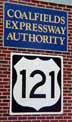
Comments: West Virginia and Virginia are proposing a newfour-lane route to run from US 23 at Pound, Va., to the West VirginiaTurnpike near Beckley. This route will roughly parallel VA 83 inVirginia and WV 83 and WV 16 in Virginia. The route is called theCoalfields Expressway and will be numbered US 121 once completed.This despite the fact that the route will not intersect US 21, whichno longer runs through West Virginia. In fact, the route will noteven touch the old alignment of US 21 in West Virginia (whichconsists of US 19 in the Beckley area). Construction is taking placein isolated spots in West Virginia. The Coalfields ExpresswayAuthority has an office at Pineville (county seat of Wyoming County)and a huge US 121 sign adorns the outside of the building.

Enters state: FromVirginia, Monroe County, at Peterstown.
Leaves state: Into Maryland, Preston County, north of SilverLake.
Counties: Monroe, Greenbrier, Pocahontas, Randolph, Tucker,Preston.
Major Cities & Towns: Lewisburg, Marlinton, Elkins,Parsons.
Comments: Traversing some of West Virginia's most scenicareas, US 219 is a major thru route despite its crooked, mountainousalignment. It enters the state just two miles shy of its terminus atUS 460 in Rich Creek, Va., and runs through a scenic valley whichturns into rolling countryside nearing and north of Union. North ofLewisburg, the route crosses forested mountains, picking up WV 55 forthe journey north to Elkins. With US 250 and WV 92 joining the routeat Huttonsville, four numbered highways approach Elkins from thesouth. Between Elkins and Thomas, US 219 will carry ARC Corridor Htraffic once that route is completed. Currently, the route isfinished only to Kerens, north of Elkins. The highway in this area isimproved as it crosses the mountains of the upper Potomac highlandsin the Monongahela National Forest. It exits into Maryland nearBackbone Mountain, that state's highest point.
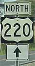
Enters state: FromVirginia, Pendleton County, south of Franklin.
Leaves state, Into Maryland, Mineral County, at Keyser.
Counties: Pendleton, Grant, Hardy, Hampshire, Mineral.
Major Cities & Towns: Franklin, Petersburg, Moorefield,Keyser.
Comments: Even numbered US highways are supposed to runeast-west, but US 220 is a blatant exception to that rule. It runsnorth and south and is a major thru route in the Potomac highlandsand eastern panhandle of West Virginia. From its entry into the stateto its intersection with US 50, it generally follows the valley ofthe South Branch of the Potomac River. In fact, a bridge across theriver at Upper Tract is one of the last remaining one-lane bridges onthe US highway system. The route picks up WV 28, another majornorth-south route in this part of the state, at Moorefield and theroutes separate at Junction, where US 220 turns to follow US 50 westwhile WV 28 joins US 50 east. The routes separate after being joinedfor about 10 miles and US 220 turns north again to leave the state atKeyser, on the banks of the North Branch of the Potomac. Once inMaryland, US 220 parallels the river and the West Virginia line untilit reaches Cumberland, Md.
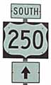
Enters state: FromVirginia, Pocahontas County, west of Monterey, Va.
Leaves state: Into Ohio, Ohio County, at Wheeling.
Counties: Pocahontas, Randolph, Barbour, Taylor, Marion,Wetzel, Marshall, Ohio.
Major Cities & Towns: Elkins, Philippi, Fairmont,Moundsville, Wheeling.
Comments: Although US 250 is an even-numbered state rotue andis signed as an east-west route in Virginia and Ohio, it is signed asa north-south route in West Virginia. For the most part, it is awinding, hilly to mountainous highway. It enters the state in anespecially scenic area of the Monongahela National Forest, thencarries WV 28 and then WV 92 northwestward. At Huttonsville, US 219and WV 55 join the route and the four numbered highways approachElkins from the south. US 250 briefly joins Corridor H (US 33) beforeit turns north, crossing the famous Philippi Covered Bridge beforeentering Fairmont. From there, the route continues northwestward andenters the northern panhandle. It joins the four-lane WV 2 atMoundsville before exiting the state at Wheeling.
Enters state: FromVirginia, Jefferson County, south of Charles Town.
Leaves state: Into Virginia, Jefferson County, at Harper'sFerry.
Counties: Jefferson
Major Cities & Towns: Charles Town, Harper's Ferry.
Comments: West Virginia's easternmost US route, US 340 servesCharles Town and then leaves the state at Harper's Ferry, re-enteringVirginia before crossing the Potomac River into Maryland. Most of theroute in West Virginia is four lanes; the exceptions are the sectionsbetween the Virginia state line and Charles Town and a short portionnear Harper's Ferry.
Begins: At US 340,Jefferson County, at Harper's Ferry.
Ends: At County Route 340/9, Jefferson County, Harper'sFerry.
Counties: Jefferson
Major Cities & Towns: Harper's Ferry.
Comments: This spur route provides access toìdowntownî Harper's Ferry, site of a historic Civil Warbattlefield.
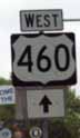
Enters state: FromVirginia, Mercer County, at Bluefield.
Leaves state: Into Virginia, Mercer County, east ofPrinceton.
Counties: Mercer
Major Cities & Towns: Bluefield, Princeton
Comments: US 460 throughout West Virginia is part ofAppalachian Corridor Q, which links Pikeville, Ky. to Christiansburg,Va. Not all the route in Kentucky and Virginia is completed, but fromGrundy, Va. to I-81, the route is finished and this includes the WestVirginia portion. The entire route is four lanes. US 460 bypassesBluefield, Va. and Bluefield, W.V. to the south. It is joined brieflyby US 52 and then US 19, which was co-signed along the route fromClaypool Hill, Va., to Bluefield, Va., rejoins the alignment betweenBluefield and Princeton. The route intersects I-77 at the southernterminus of the West Virginia Turnpike and then continues east,re-entering Virginia at Glen Lyn just west of the NewRiver.
Enters state: FromVirginia, Morgan County, northwest of Winchester, Va.
Leaves state: Into Maryland, Morgan County, north of BerkeleySprings.
Counties: Morgan
Major Cities & Towns: Berkeley Springs
Comments: Like US 220, US 522 is an even-numbered US highwaywhich runs north-south in violation of the numbering convention forUS highways. It is a two-lane route that is heavily used as a truckshortcut between I-81 in Virginia and I-70 in Maryland andPennsylvania. West Virginia has a long-range plan to widen the routeto four lanes to eliminate traffic hazards. The highway narrows fromfour to two lanes upon entering West Virginia from Virginia. Once theroute enters Maryland, it intersects I-68 and I-70 and thenimmediately enters Pennsylvania.
WestVirginia Highways Home
GoBack to the Millennium Highway Roads Page
GoBack to the Millennium Highway Home Page
Copyright© 1997-2003, H.B. Elkins
This page created Nov. 17, 1998.
This page last modified June 3, 2003.