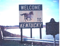
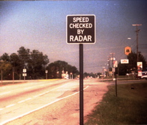
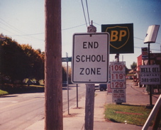
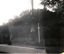
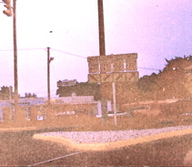
Taken in 1984, this was the old welcome sign on US 45 near Paducah as that route crossed the Ohio River from Kentucky into Illinois.
|
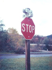
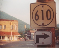
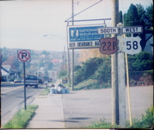
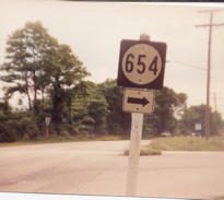
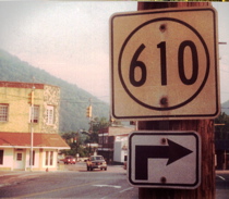
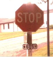
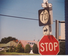
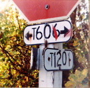
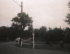
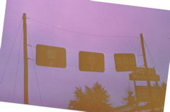
Taken in 1984, this sign near Paducah shows how at the time some state highway districts were still using circular signs for four-digit routes. This is not common practice in Kentucky anymore except for District 12 and a few other areas.
|
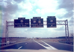
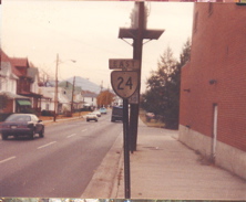
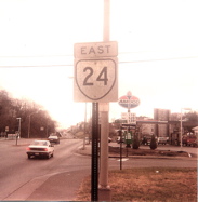
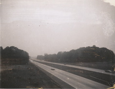
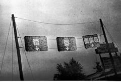
1984 -- eastbound on I-24 at the Purchase Parkway.
|
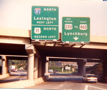
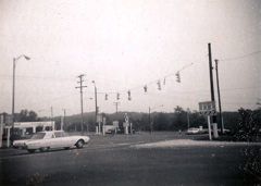
1979 -- just south of I-64 and I-75 at Exit 113 in Lexington.
|
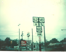
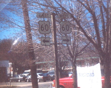
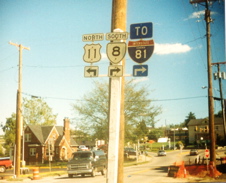
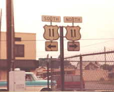
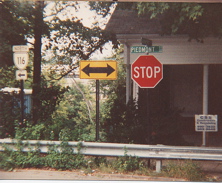
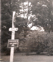
1975 -- in Paducah. This would be heading west on US 60 and US 62.
|
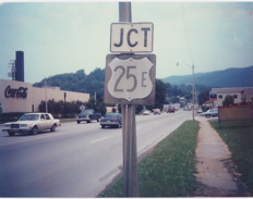
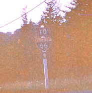
1992 -- surprising that this old US 25E sign was still around at that late date. This is on KY 74 in Middlesboro.
|
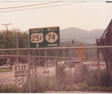
1992 -- looking south on US 25E toward Cumberland Gap, back when the tunnel was under construction and 25E still skirted the westernmost tip of Virginia before entering Tennessee. This sign, very unique for this part of the state, stood for years.
|
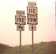
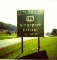
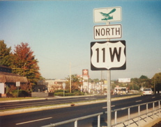
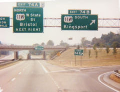
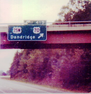
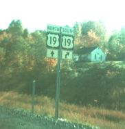
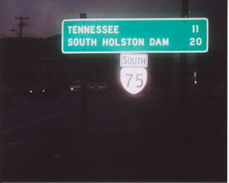
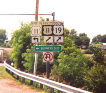
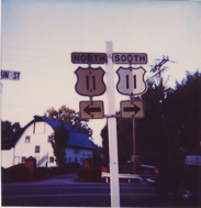
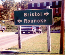
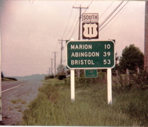
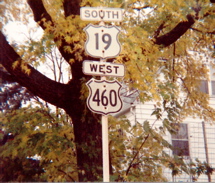
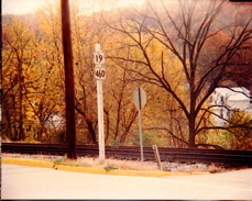
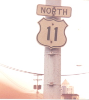
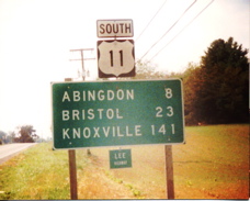
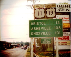
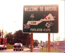
Now we're in Tennessee in 1995. This is on US 11E/US 19 just south of Bristol, where US 19 splits into its component east and west alignments.
|
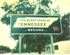
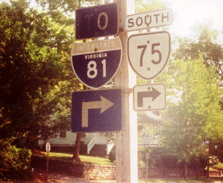
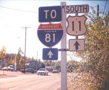
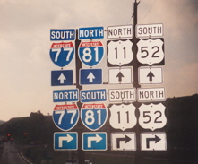
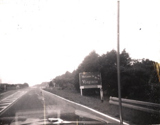
1995 -- looking south on I-81 just after entering Tennessee from Virginia. This was taken at the Tennessee welcome center.
|
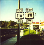
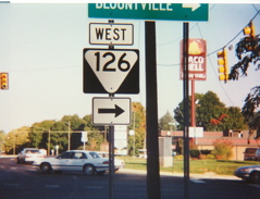
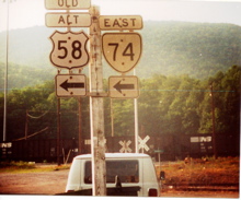
1995 -- approaching US 11W from Tennessee 126.
|
1995 -- just past the TN 126 junction.
|
1995 -- heading north on US 11W.
|
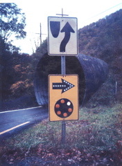
1995 -- this unusual "side roads" marker was on TN 358.
|
1995 -- this is the end of TN 358 at US 11E/US 19. The overhead street sign mounted on the wire indicates that this is in Bristol.
|
1996 -- this is on TN 91 heading south just after the route enters the state from Virginia.
|
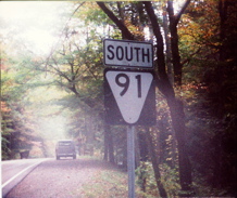
1996 -- the first TN 91 marker south of the Virginia state line.
|
1998 -- this is south on I-81, just after entering Tennessee from Virginia.
|
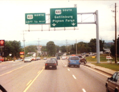
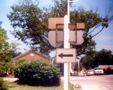
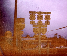
1998 -- in Pigeon Forge. I have photos of this same sign assembly from roughly the same time period.
|
1998 -- This is on TN 66 approaching what locals call "The Big Intersection" in Sevierville.
|
This is looking north on US 441 approaching the Forks Of The River Parkway in Sevierville in 1998.
|
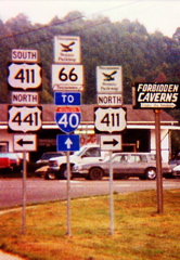
1998 -- looking at signage at the beginning of TN 66.
|
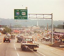
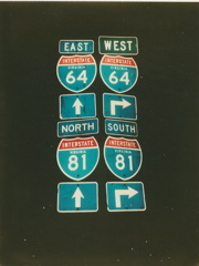
1998 -- on I-40, direction of travel not noted.
|
1998 -- on I-81, again, the direction of travel was not noted.
|
1975 -- on US 41, entering Tennessee from Kentucky.
|
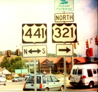
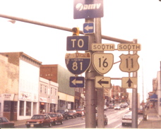
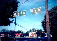
1995 -- In Bristol.
|
1999 -- we're in West Virginia now, looking north on WV 16 in McDowell County.
|
1999 -- this is on WV 16 north, just past the WV 161 intersection and the Virginia state line.
|
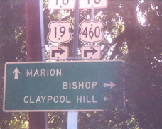
1999 -- this is the end of WV 161 at WV 16, right at the Virginia state line at the town of Bishop.
|
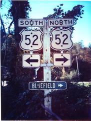
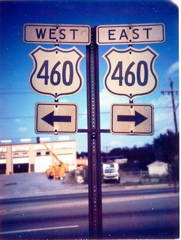
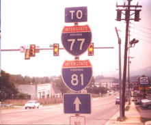
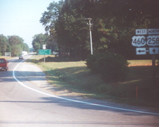
1998 -- this is on US 460 heading east at the I-77 interchange at Princeton.
|
1998 -- some wrong-way multiplex action going on in Bluefield. I have shots of this signage from that year as well.
|
1998 -- looking north on US 19 and the former route of US 460, entering Bluefield WV from Bluefield VA.
|
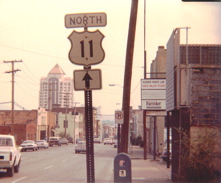
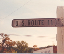
1995 --this is looking north on US 11 in the panhandle community of Bunker Hill and is of interest for the old-style street light above the sign.
|
1989 -- looking north on US 119 at the WV 65 intersection.
|
1995 -- this old-style I-81 sign was photographed mounted on one of the garages at the WVDOT maintenance yard north of Martinsburg.
|
1978 -- looking east on I-64.
|
1978 -- the sun glare makes it hard to see, but this is in Rainelle where WV 20 joins US 60 east.
|
1978 -- this is looking east on US 60 at the US 19 interchange between Summersville and Fayetteville.
|
1978 -- button copy lane signs where US 60 and the WV Turnpike intersect south of Charleston.
|
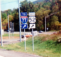
1996 -- where US 52 leaves US 460 east near Bluefield.
|
1978 -- what's interesting about this is the inclusion of a WV 214 sign on the US 119 south exit.
|
1978 -- in Charleston where I-64 joins I-77.
|
1978 -- crossing the Kanawha River on I-64.
|
2002 -- in Parkersburg. I have a shot of this assembly from a few years earlier.
|
2002 -- crossing from Parkersburg, WV into Belpre, OH.
|
1978 -- near 14th Street in Parkersburg.
|
1978 -- at the same intersection as the previous photo.
|
2002 -- looking south from I-77 at old US 21. This is at Exit 132.
|
1989 -- this is crossing from Kentucky into West Virginia near Kermit, where KY 40 ends.
|
1978 -- crossing into West Virginia from Kentucky on I-64.
|
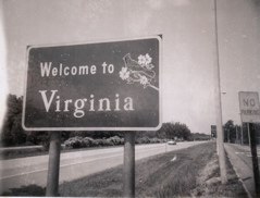
1992 -- now we move onto Virginia.
|
1978 -- On US 11 at Exit 195.
|
1992 -- this is the divided underpass on VA 311 that I photographed in 2003.
|
1992---south of the VA 661 exit of I-64, Alleghany County
|
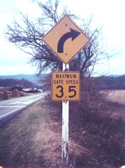
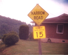
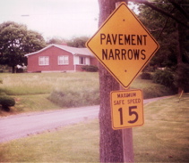
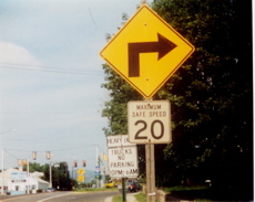
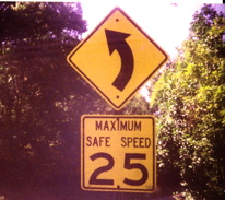
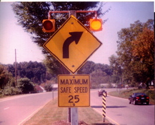
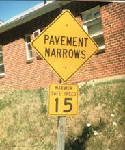
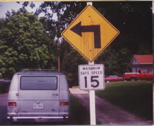
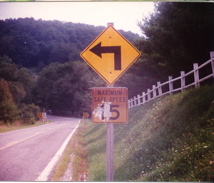
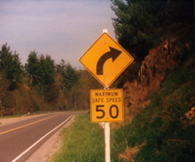
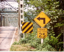
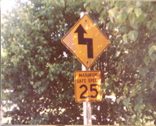
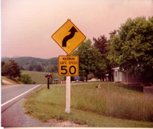
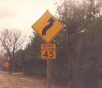
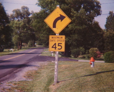
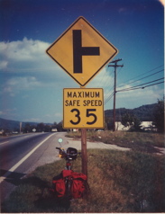
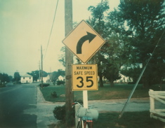
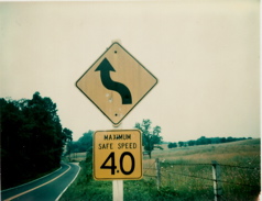
On VA 311, no date. Years ago, Virginia used the text "maximum safe speed" on its speed advisory signs for curves. Now Virginia uses the standard "XX mph" advisory plates.
|
1992 -- on VA 311.
|
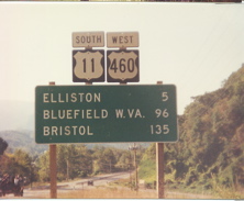
1992---US 11/460 north/east on a former alignment just north of Elliston. Here the N/E lanes of the divided highway broke away from the opposite lanes then narrowed to a one lane bridge over the railroad tracks. Later the highway was relocated and widened along the opposite lanes
|
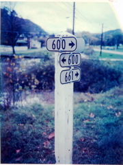
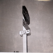
1992---Alleghany County. This location is just south of the I-64/US 60 overpass along 600. Mr. Summa says, "I seldom took shots of the present 9"X 24" size secondary route signs, instead I was only interested in the old 4.5"X 12" small size, which "got me" ever since I first traveled thru VA in 1962. There were still many of the small sizes posted in the western border counties then. Now they are very hard to find."
|
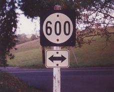
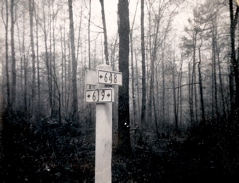
1992---VA 600 in Wythe County
|
1991----E. Orange Ave on the East side of Roanoke from a side street, probably posted before US 221 was added to this alignment.
|
1991----US 11 is missing here after joining just north of Downtown Roanoke
|
1992, west side of Roanoke
|
VA 118 south, an odd assembly, rather than show an advance turn for each direction ahead you get two straight ahead arrows. Then again, "JCT (route)" postings are extremely rare in this region of VA.
|
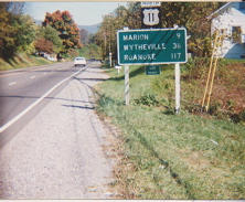
1992---VA 660 north where US 11 crosses over I-81 between Seven Mile Ford & Marion, Smyth County
|
2003, N. Franklin St at Depot St. (still standing) should have a BUSINESS banner here
|
2003, looking south on VA 154 in Covington, a very poorly marked route thru the city
|
2003, looking N on VA 154 in Covington
|
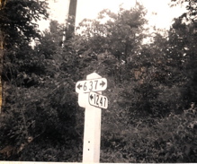
2002, VA 737 south, this is at the interchange # 26-Emory on I-81, Washington County
|
same spot as previous photo looking south on 737
|
2002, an oddity here south of I-81 exit 17, the route marker is usually on top of the mileage signs, and just "TENNESSEE" rather than "TENN STATE LINE" used as a control point
|
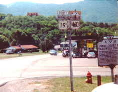
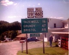
2001, in Tazewell.
|
2001---along VA 16 North just past BUSINESS US 19/460
|
2001---I needed a close-up shot here for tracing purposes. In Tazewell.
|
2001----a short distance before the VA 61 jct. In Tazewell.
|
2001 (I think)----New signage after the US 460 freeway completion from I-81
|
again, I think 2001----the far south end of the # 118A-B interchange of I-81, this is where the freeway ramps end & the road goes to surface street status
|
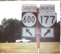
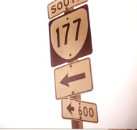
2001 (?) end of I-81 south exit 109 ramp & the only decent looking 177 marker around these here parts ( In my humble opinion of course)
|
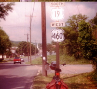
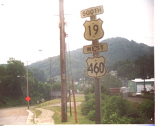
2001---pretty close to the old days here, whitewashed, pyramid top cut timber posts, & US outline in a white square, but of course they just HAD to off-center the "19" (This is in Abingdon, just north of where US 19 splits off US 11 and just prior to US 58 Alternate joining).
|
2001---looking in the other direction here ARE the old days....Black paint fading around the US outline showing the old all-white background design, the 9" X 24" direction tabs & distinctive arrows....I sure do miss them!
|
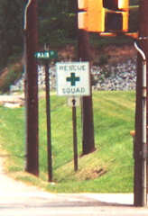
2001---I think was in Wise, a directional arrow under the old Rescue Squad sign
|
2001 ---Big Stone Gap
|
Up close & presonal for the common circle-in-a-square style I first saw in the 1960s
|
2001---missed the top portion with the 3 tabs here in Norton
|
Missed more in Norton
|
I was on a real roll of missing the top tabs here
|
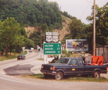
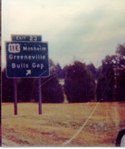
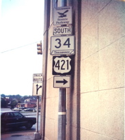
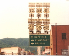
2001. This is at Gate City where US 58 and US 421 split from US 23.
|
2001---A variety pack of sorts
(Note: This was after the "Buisness" misspelling was corrected.)
|
2001----Valley Rd. at Reservoir Rd in Abingdon on the mystery section of VA 75
|
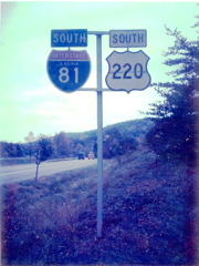
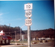
2000 (?)--- In Iron Gate, the community along US 220 at the ALLEGHENY/BOTETOURT county line
|
2000---a block south of US 60 just south of I-64, exit 27, community of Cliftondale Park
|
2000, just north of where US 60 left the route in Covington
|
2000---old alignment of US 60/220 W/N approaching the newer one off exit 16 of I-64
|
2000----too much for Clifton Forge to add a "TO" banner, I guess
|
2000--You've seen this before but another look can never hurt
|
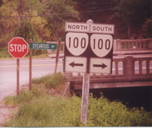
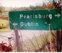
1999----Pearisburg old street signs along US 460/VA 100 just north of downtown, and of course a WPTTP (whitewashed pyramid top timber post) Stop sign in the background
|
1999---VA 720 at US 460 entrance, Bluefield
|
1999---The right way just past VA 720
|
1999----VA 102 EAST beyond downtown Bluefield (old style 90-degree turn sign...)
|
US 19 SOUTH/US 460 WEST on the west side of Bluefield, that is Greevey Ave ahead. according to the map this is Virginia Ave which turns right ahead as well. (old-style turn sign with newer speed advisory marker)
|
1999----First set of markers past the WV state line
|
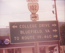
1999---a short distance south of downtown & the VA 102 crossing (Bluefield)
|
1999----WV line to the left, Bluefield College to the right
|
Town of Bland, 1999
|
Town of Bland, 1999
|
1999---Community of Sylvatus, I think this was VA 749 END, northern Carroll County
|
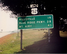
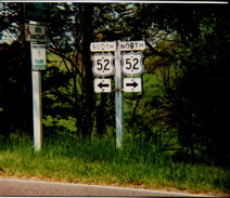
US 52 SOUTH just beyond the Blue Ridge Pkwy junction
|
2000----Iron Gate
|
2000---18" size secondary marker in Boones Mill, that is US 220 ahead. It appeared that the 12-county district of Salem uesd their own distinctive fonts, such as these numerals. I never saw them in any other area of the state
|
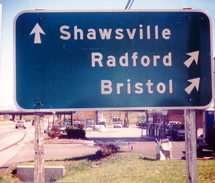
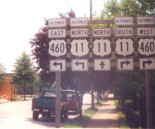
2000----US 11 NORTH/US 460 EAST, Shawsville
|
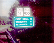
2000, Front Royal, US 340/US 522/VA 55 turn north (VA 55 WEST) at this intersection, north side of town
|
2000, Front Royal, and you thought US 55 wasn't around anymore
|
2001, just south of where US 19 joins US 11 on the south side of Abingdon
|
US 11 North, Abingdon
|
US 11 north, north side of Abingdon, 1995
|
1995, can't remember which direction this was looking
|
old VA 609 at US 11 north side of Abingdon
|
1995, one sign at VA 615 END, Floyd
|
1996---town of Stuart, VA T1009 at VA T631
|
1996---Instead of a route marker above the double arrow sign you get a speed limit here at the intersection of VA T1000 & VA T1017 in Hillsville
|
1996----just outside of the town of Hillsville
|
1996
|
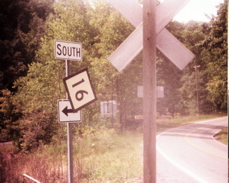
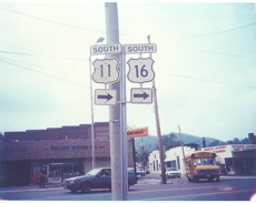
1996---VA 16 SOUTH
|
2003 ( I think ) Here's that shot I told you about with the first replacement of the old I-81 shields. Probably if not for this photo, this would still be standing
|
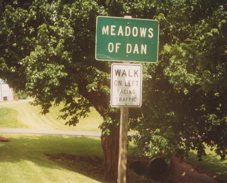
1996---Meadows of Dan, END VA 758
|
1996----Hillsville, just beyond the US 58/221 crossing
|
1996----E side of Wythville US 11 joins the interstate
|
1996
|
1995----US 11 SOUTH western Smyth County, between Seven Mile Ford & Chilhowie
|
1995---You've seen this before...Here's another look
|
1996---VA 94 END
|
1996
|
1996---Just past the VA 107 junction in Chilhowie
|
1996---One piece older style four route marker sign at VA 611, just north of exit 13, I believe, of I-81/US 58
|
1995---3 years after the first photo I took of this assembly, US 411 remained standing
|
1995 (Bristol)
|
1996---flash effect didn't work that well here
|
1996(?)---south side of Wytheville
|
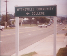
1996(?) enterance to Wythville Community College from US 11
|
1996(?)---a liitle ways up from the previous photo, one of the old 9"X 12" directional arrows used with the old embossed border/flat painted copy cut outs
|
1996---the best I could improve a poor picture
|
1996---You've seen it before, but likely don't mind seeing it again
|
1996 again
|
1996
|
1996---before the older style black outline shield in a white square signs were erected here.
|
1996---about the shortest distances you can get for 3 conrtol points
|
1996---South end of Main St. (T1004) thru Chilhowie. That is US 11 south straight ahead
|
1995--- West BUSINESS US 460 in Blacksburg. Since this was a yellow & not a constuction orange sign, I thought I was seeing double from a distance
|
1995---Radford city street, an official looking VA curve arrow, but who "centered" it?
|
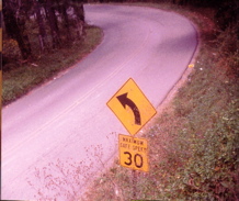
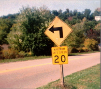
VA 232 north in Radford, no F in SAFE
|
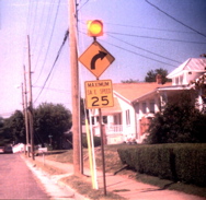
1995----VA 232 North goes from 4 lane divided to 2 lane city street in Radford. Oversize variation of the Maximum Safe Speed sign (still stands)
|
1995---A short distance before the previous shot
|
1995---Old pre-orange portable constuction sign at a Chilhowie scrap yard
|
1995---City of Radford, still stands but in worse deteriorated condition, Former VA 611 near VA 177
|
1995---Nearing the entrance to one of the Radford Army Ammuniton Government properties in Dublin. Not a VDOT sign. This road, now VA 1030, apparently was maintained by the US govermment, or some branch thereof. All the signing was standard contracted.
|
Looking north on VA 100, past VA 608, SE Wythe County
|
VA 608 looking east
|
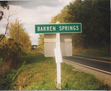
looking from the opposite side at the same intersection of the previous photo, these Barren Spgs shots were 1995
|
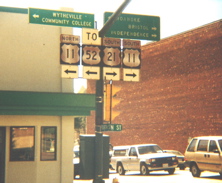
1995---Downtown Wytheville. Note how a section of the TO sign was cut away to fit next to the mast arm. Looks like this assembly was in place when US 52 did turn left here before the interstate was completed. I just got a postcard on eBay that supports this theory
|
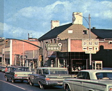
A section of the aforementioned postcard, note here US 52 was signed east/west
|
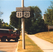
1995----looking south from the 11/21/old52 downtown intersection. No oldies here
|
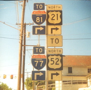
1995 I think. I also think this photo is posted already somewhere but since I'm not sure here it is anyway. Located 1 block north of US 11 in downtown and still standing last fall when I was down that way
|
1995, Town of Bland
|
1994 VDOT maintenance yard at Dublin. One of the old small size secondary signs, the blank back side used for marking sections inside the grounds
|
...and another...(I just could never get enough of these small size markers)
|
1994 and the older "Salem District" font
|
1994 (about)----You've seen this one before but here the sign was relocated while building construction was going on, then returned to it's original location
|
1994---just beyond the US 52 crossing in Hillsville
|
Town of New Castle, VA T615 north
|
1994---VA 42 north in Craig County
|
1994---VA 8 North of Floyd, looking north
|
1994---US 58 West
|
1994
|
US 11 north about to join the interstate on the east side of Wytheville
|
1994---a little too close here a short distance from the previous shot, at the south side frontage road of I-77/81
|
1994---In the grounds of Hungry Mother State Park, near Marion
|
1994---Bad enough another US 16 mistake, but can those directional arrows be any smaller?
|
1993 or 4---Downtown Christiansburg close up as US 460 business turns left & joins US 11 north also above this assembly was "TO VA 8 right"
|
1994-- view of VA 100 looking south from the NRV airport outside Dublin
|
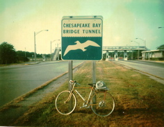
1994---same spot as previous photo, older directional sign & the 'ol trusty now retired bicycle (the best way to get sign photos)
|
VA 624 crosses US 11 near Fairlawn, Pulaski County
|
1994---END VA 177 in Radford
|
1995---I can't even recall the exact town this was in , somewhere along US 11 between Harrisonburg & Winchester was this old dead blinker (a moment of silence, please) along some town street
|
1995---old portable construction sign at Waynesboro DPW
|
1995---No need for the white TO banners here, this IS 17/50/522
|
...and the other side...
|
1994---US 11/460 north/east at I-81 exit 118 before I-81 was widened here & the US 460 freeway was added with the C/D lanes
|
1995----New Market, A good look at the difference in size between the small & largrer sizes of the secondary route signs, posted here, one on each side. This is at US 211, & I-81 is just ahead
|
1995---Beuna Vista on US 501 North
|
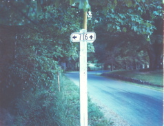
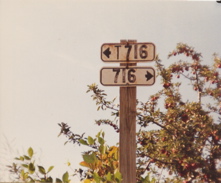
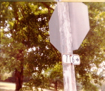
1995---A short distance off US 11, just north of exit 195 of the I-81/64 overlap near Fairfield. This one has the older non-reflective surface & there weren't that many with this type of arrow arrangement.
|
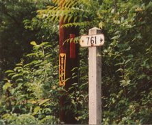
....and across the street....that's the 716 in the previous shot in the background..... I sure wouldn't have minded having my mailbox next to one of these.....
|
1994---About a mile south from downtown Christiansburg, you could have taken VA 8 about a half mile back to I-81. From here it's another 11 miles via the signed routes
|
VA 111 END at US 11/460, this old arrow sign has been replaced
|
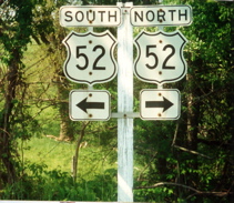
1993----US 52 NORTH crossing the New River in Wythe County, north of Poplar Camp. This bridge is no longer,so forget about the sign still being there
|
1993---Cut outs still survived in Independence. You can see some of the Grayson County Courthouse building in the background. The cut outs were gone by the following year.
|
Now check out the shape of the US 21 here, note the elongated point at the bottom (don't drop this type on your foot). A few of these were scattered about southwestern VA but not many. Also the 221 here looks like it was painted over a 21.
|
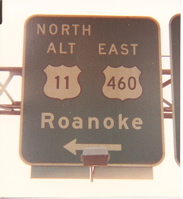
1993---That ROANOKE sign at the bottom was the old cat-eye marble type
|
1993---Pearisburg and that's just rust on the 460s
|
1993---VA 100 SOUTH approaching Pearisburg and the old "divider line" of sorts from the past
|
1994---A slight variant on the old reverse turn signs in Shawsville visible from US 11/460 on VA 609
|
1995---Yes, you've seen this before, that was the vertical polaroid shot, this assembly warrented a second shot with an old Kodak camera
|
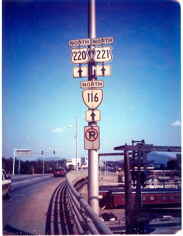
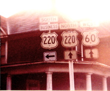
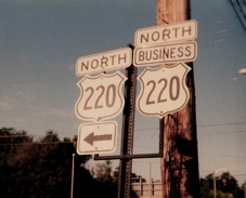
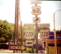
1992---US 220 SOUTH
|
1992 at I-81
|
1994---VA 121 END
|
1994---The back of the routes go left? Actually the arrow points to a parking area, the sign is "SOUTH 11-TO 8" in downtown Christiansburg.
|
1994---US 11 NORTH, VA 365, the route to Wytheville Community College, is just ahead. These old specs shields , still standing by the way, are oddly not screened at all. The red & blue fields are over old Silver Scotchlite, with the copy cut out showing the silver unerneath. Rather unusual.
|
1994---And speaking of Wytheville, right after US 21 leaves, of course, is "the big pencil"
|
1994---Again, those color-over-silver scotchlite I-shields.
|
1993---Grade separated junction of US 11 & VA 100 at Dublin
|
1994---US 11 NORTH approaching the I-81 junction at interchange # 73, a northbound only exit, the roadway goes from 2 to 4 lanes divided from here into Wytheville
|
1994---Older 18" advance secondary signage on US 11 NORTH in western Wythe County near Rural Retreat.
|
1994---Old style along US 11 on the north or east side of Pulaski
|
1993---US 11 NORTH/US 460 EAST about to descend Christiansburg Mtn. next to the Christiansburg Wayside
|
While this photo was taken around 1993, these signs are still standing
|
2000 or so---Temporary detour cut out shields
|
2003---Close up of the Interstate shield-in-a-Virginia primary SR cut out. VA 18 END at US 60/220 at Covington
|
2002----Downtown Roanoke & the 18" X 21" interstate shield-in-a-24" X 24" square
|
2002---Thaxton
|
1994----US 11 SOUTH at VA 365
|
1994---Embossed oldie on Wytheville town maintained street
|
1993---VA 617 at US 11, Dublin
|
1995---A rare find in VA, the old cable "guardrail" along a short stretch of US 58 in Lee County
|
1992---US 58 WEST nearing the end of the route in far west Lee County
|
1992---I thought I had sent this one to the "Virginia Cutout Collection" page, but I don't see it there, so here it is...
|
1992---same thing here...
|
1992---US 421 NORTH turns & joins US 11E/US 19/VA 381. Should be a double arrow under the 381. Or was it the former VA 113? now that I looked at the older maps it's not really clear. Hmmmm......
|
1992
|
1992
|
1992---didn't see these mistakes on cut outs very often, not nearly as often as seen in newer square route signs around the region. This spot is a few blocks prior to the previous photo
|
1992----two types of 220 fonts but one missing the BUSINESS banner
|
1992----Goshen in Bath County
|
Here's a section scan of a photo from THE ROANOKE TIMES inset article on I-81 a few years back, a look at the first exit number tabs used in VA, I assume. This sign faced northbound traffic. The file date is listed as 1967.
|
1992----Goshen, Rockbridge County
|
1992---about a mile south of VA 39 in Bath County
|
1993---Old signal in Wytheville looking south on US 21 as US 11 south turns right.
|
1992----Can't remember exact location. Fairfield, or somewhere near.
|
1992----western edge of town leaving Bluefield
|
1992----Heading towards downtown Bluefield from the west side of town. A closer shot is on the VA Cutout Collection page from Adam Prince.
|
1992---Please join me in a moment of silence with one of the few remaing original secondary assemblies in Rockbridge Baths, just south of VA 39
|
1992
|
1992
|
1991----This was the only I-581 old specs 3-digit size (30" X 25") standard shield I ever saw in all of the Roanoke area.
|
1991---About 3 miles NE of the community of Oriskany, in western Botetourt County, along VA 615. I tried to slowly walk across this bridge and couldn't do it. Too much sway.
|
1991---A short distance from the previous picture. VA 615 at VA 817. Why bother to build a bridge when you can just swim across VA 817?
|
1990----blurry old signage
|
1991---VA 661 at VA 683, community of Callaghan in Alleghany County, near I-64 exit 10
|
1991---Steel embossed border shields along Williamson Rd. in Roanoke
|
1991---That's the tallest building in Roanoke in the background
|
1991----Flat shield in same area
|
1991---Williamson Rd in Roanoke
|
1993---West side of Wytheville, note the old street sign. Ah, pedaling back in the days of still plentiful cutouts!
|
1993---Entering Christiansburg, these are long gone......
|
1994---close up of Radford city signage at VA 177 END
|
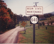
1994---Botetourt County, VA 640, One piece 11 assembly
|
1994---An odd looking shield probably made by the city of Salem. This is in downtown Salem where US 11 leaves US 460
|
Yellow arrow flasher close up for US 11 south traffic at VA 8 in Christiansburg
|
1993---Current Roanoke city signage resembling the past style. 18" marker
|
1992---Cloverdale, just south of the I-81 interchange 150/ US 220/US 220 ALT junction. Yet another US shield shape variant.
|
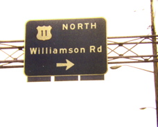
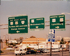
1992----US 460 WEST/US 221 SOUTH-Orange Ave. at US 11/US 11 ALT/VA 116-Williamson Rd in Roanoke.
|
1992---Troutville
|
1992
|
1993
|
1995
|
1994
|
1995
|
1994
|
1994
|
1994
|
1994
|
1994
|
1992
|
1995
|
1995
|
1994---No longer there, a newer installation was erected after the I-81/US 460 interchange # 118 A-B-C was constructed
|
1994---Just past the VA 8 junction in Christiansburg, this cut out still stands!
|
1991---13th Street in Roanoke, looking west,(south US 11) at the bridge over the Roanoke River
|
1991----Same spot as previous photo, looking in the opposite direction
|
1991---Along Williamson Rd in Roanoke
|
1995---Entering Pulaski County from Radford City
|
1991---Steel, embossed border shields along Brandon Ave at Grandin Rd., Roanoke
|
2002----Surviving one piece assembly on the east side of Christiansburg near exit 118C of I-81
|
1991---Downtown Roanoke, although this is BUSINESS US 220
|
1991---Franklin Ave at Brandon Rd., Roanoke
|
1995 (Harrisonburg)
|
2002---It was still there last fall
|
2000---Commerece Rd approaching Greenville Ave. Staunton
|
STILL STANDING (but fading fast), this shot about 2002 at VA 758 & F042 (south frontage road of I-81/77)
|
1993
|
1994 or so, none of these are still there. This assembly had been moved from across the street.
|
1993 or so ---note how the 18" VA shield comes to a point at the bottom.
|
2000
|
2000---those arrows look like they belong on the old VA destination signs instead
|
1995--- Another shot while the late afternoon shadows were approaching.....You don't mind seeing it again do you?
|
1991---US 221 turning from Brambleton Ave. onto Brandon Ave. in Roanoke
|
1991---Brandon Ave in Roanoke
|
1991---Close up of the signage at Wells & Williamson near downtown Roanoke
|
1991---Orange Ave just past the US11-Williamson Rd. intersection. That is I-581/US 220 up ahead & it looks like there must have been a "TO I-581" on this assembly at one time.
|
1996
|
1994---Yes, you've seen this one too, back before it was moved for construction then returned to this spot afterwards next to a new building
|
1996 or so
|
1994--- Downtown Salem and it's been quite a while (like 1926-1935) since US 311 was last seen in these parts....from nearby Roanoke south on today's US 220 routing.
|
1994---Right after VA 8 END in Christiansburg
|
1994 or so before this section of I-81 had exits 118A-B-C & the C-D lanes for the US 460 freeway connection
|
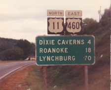
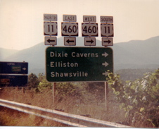
1992---Dixie Caverns
|
Downtown Christiansburg around 1991
|
1992
|
1995---Salem ,at a point where US 11 NORTH is actually heading near due south
|
1991---The other set of signs with this distinctive US 460 shape is on the Vintage VA photography page of Adam Prince
|
a closer look at what Adam described as a "chipmunk" looking shield.
|
1994---VA 647 right after I-81 exit 132
|
1994---One piece assembly at VA 111 END. It should also be signed as BUSINESS US 460 here, but who's going to mess with this giant of a sign?
|
This was 1991 & "BUSINESS" banners were still not used with the US 460 shields in downtown Christiansburg. BYPASS US 460 was not yet converted to freeway status
|
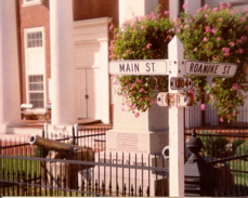
1993---At the corner of Main St & Roanoke St. in front of the old Christiansburg Municipal building were the older shields. With the new building came the removal of these with newer cut outs now on the other side of the street
|
1991
|
1991---same spot in Salem
|
1991
|
1991---Close-up--How's this for old signage? VA 117 has been extended south since then
|
1994 -- Dublin
|
1991
|
1995---US 11 looking north at a school entrance near Seven Mile Ford
|
1991---Roanoke, the bridge over the Roanoke River, that sign is an advance left angle turn for US 11 NORTH but even the backs of the cutouts looked good to me
|
1990---From the Roanoke Civic Center parking lot
|
1998---Newer signage after crossing US 11 in Salem
|
1998---VA 927 in western Roanoke County. US 460 is missing here, not only the sign, banner & arrow but the whole right side of the assembly bars. Had they been broken off by a passing vehicle, It should be the left side, don't you think? How did this happen? One of those "Mysteries of the Highways" I guess.
|
1994---Missed all the TO banners on this shot. VA 623 END at VA 600 near Fairlawn, Pulaski County (still standing)
|
1991
|
2000---US 11 looking south at the US 211 turnoff in New Market. All the cut outs that were there in 1995 were gone, but one small secondary sign against the backdrop of the assembly meant I had to get this patriotic shot
|
1993--Older signals (since replaced) at Roanoke & Main US 11/US 460 BUSINESS, Chriatiansburg
|
1991---Wells Ave & Williamson Rd near Downtown Roanoke. Best I could do here was a shot from across the street.
|
1993---Older oversize curve arrow on US 11 SOUTH, approaching Radford
|
2000---Rockbridge County old sharp pointed arrows
|
US 11 south past US 340 END in 1995
|
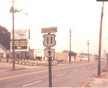
1995---US 11 SOUTH enter VA
|
1995---This just looked too good to pass up, even covered over from when it read DEPARTMENT OF HIGHWAYS but still the old posts. US 11 looking north near Edinburg, Shenandoah County
|
1992----US 11/US 19 SOUTH (& former US 58 WEST before I-81) Very official looking to me!
|
1995
|
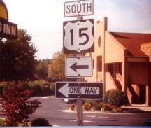
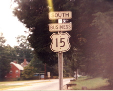
1999---US 15 BUSINESS SOUTH
|
1999---a short distance from the previous spot
|
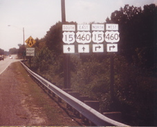
1999--Looking NORTH on US 15 BUSINESS past the US 460 interchange towards Farmville
|
1999--US 460 WEST
|
1999
|
1999
|
1999
|
1994---US 58 WEST/US 221 SOUTH past VA 89 END in Galax. The sun wasn't quite where I wanted it for this shot, 3 ways to keep right.
|
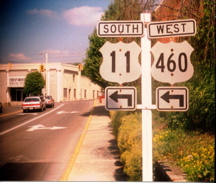
1996---I was more interested in the black 460 shield here than the other sign while approaching Bluefield on US 19 NORTH/US 460 EAST
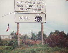
(Note from H.B. -- wouldn't this be an error? If you are going north on US 19 and east on US 460, you will not encounter any tunnels if you enter I-77 northbound because you will do so in West Virginia. You will encounter the tunnels if you go SOUTH on I-77).
|
1992----US 11 south at Cloverdale. VA 604 was modernized into US 220 ALTERNATE. Somehow the "olde" doesn't fit in well with the "newe" style street sign here to me.
|
1993---US 460 BUSINESS WEST about to merge with US 460 BYPASS WEST before this became a freeway interchange on the north side of Christiansburg
|
1994---VA 611 north of Pulaski (gone, but not forgotten here), I don't know if this was an old state sign or not. This area is now within the Pulaski city maintenance. This one was wood
|
2003---View along US 220 SOUTH heading towards Covington near the Alleghany/Bath county line
|
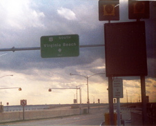
2002----Apparent Virginia Beach city signage along VA 408 NORTH
|
2002----US 58 EAST approaching VA 408
|
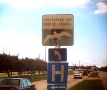
2002 ----Looking south on Island 1 with the pier and resturant on the CBBT
|
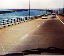
2002----South US 13-CBBT after leaving Fisherman's Island
|
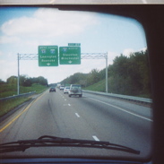
2002----poor quality shot as I-64 WEST prepares to join I-81 SOUTH
|
2002----A shot out the side window as we crossed US 258 on US 460
|
2000----Nice map detail on a wooden sign on the Blue Ridge Parkway
|
1994----Christiansburg town street as a church used these old VA 314 cutouts for a slow/children & speed limit hand painted signs.
|
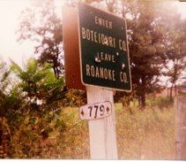
1992-----VA 779, Botetourt County near Daleville.
|
1992----Oversize arrow on US 11 SOUTH/US 460 WEST in Elliston. This particular curve alignment has since been straightened therefore eliminated.
|
1991---somewhere in Roanoke County
|
1991---off VA 779 in Botetourt Co.
|
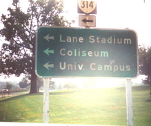
1994----A different mounting method on the campus of VPI, more commonly refered to as Va. Tech. (VA 314). Was Virginia Polytechnic Institute too tough for them to remember or spell?
|
1994---VA 314 again
|
1995---Segment beginning of VA 42 at US 460
|
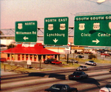
1991---Lynchburg signage. Those banners are 18" wide so it appears these are maybe 21" squares for the US routes
|
1990---Red fire station signals in Roanoke
|
2000---I sure had a habit of getting too close or being off centered. You'd think all the years I'd been doing this I would have gotten better alignments. Maybe it was too much excitement & I could never hold the camera still enough or point it straight.
|
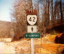
1995---Segment of VA 42 END at Newport.
|
1992----Entering Bedford along the US 460 expressway
|
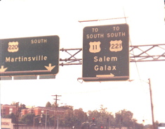
1996---Former VA 57 in Martinsville. Another angle of this shot comes later
|
1992---close up at VA 419 south
|
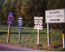
1994---VA 717 END at US 52 in northern Wythe County. I equalized the I-77 sign which could hardly be seen at all in the shadow here
|
1999---VA 675 END south of Hillsville.
|
1994---Older signs near exit 109 of I-81
|
1992---Lynchburg
|
1992---Not even TO "route" 460 as previous VA mileage signs were worded
|
1993
|
New next to old around 1995
|
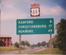
3 "VILLEs" ahead around 1995
|
2001---Not sure if I sent this already so in case I didn't....
|
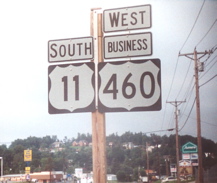
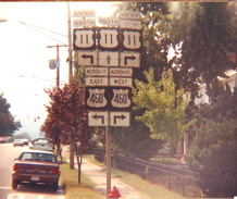
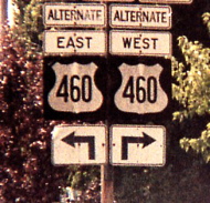
By the time this was taken, around 1996, US 460 had already been relocated to the new expressway, but like the city of Bluefield, VDOT also had not removed any the US 460 signs along US 19
|
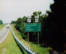
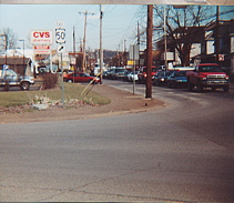
2000---Blurriness cannot diminish the grand combo of US 17/US 50
|
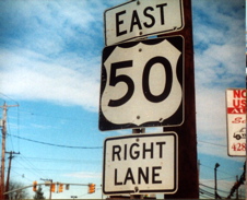
2000----When I tried to improve the quality of this photo I came up with this glowing effect. Now if only they were older shields
|
1993---the old Christiansburg municipal building in the background. These borderless variants are still there
|
1990---Franklin Ave at Wonju St., Roanoke
|
1995---If you can't read the sign on the left it's the Wytheville town limits
|
1997---Along VA 16 NORTH in Tazewell
|
1999----the way VA 102s are supposed to look
|
1991----VA 116 NORTH at US 460/ US 11 ALT, Roanoke
|
1990---Bullitt Ave at 9th St, Roanoke
|
1990
|
1995
|
close up of the v331 shot, once again looking like the post was cut to remove the US 21 shields that once stood here also
|
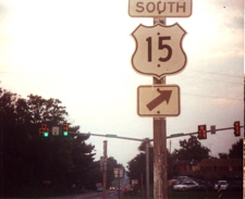
2000---US 15 leaves US 522/VA 3 in Culpeper, only a block from US 29
|
1994 or so, not quite the best spacing arrangement here, VA 16 SOUTH turns right here
|
1990----Orange Ave in Roanoke. Probably erected prior to US 221 being extended to Lynchburg along this alignment
|
1991--Elm Ave., Roanoke
|
1991---Main St., Roanoke
|
1992---Business US 220 on the north side of Rocky Mount just off the US 220 Bypass
|
1992---Just past the VA 122 split on the NE side of Bedford
|
1992---VA 18 END
|
1992
|
1992---BUSINESS US 15 leaves BUSINESS US 460 in Farmvllle
|
1992---Also BUSINESS US 15/460 split. While trying to improve this shot I came up with this "rays of light from Heaven shine down upon VA US cutouts" effect. Had to leave it like this!
|
2003---VA 600 looking north in the community of Mountain Grove, off VA 39, western Bath County
|
2002---US 13 NORTH after the CBBT toll station, Kiptopeke
|
1992---18" marker along VA 634 past the BRP (no connection) in Roanoke County, east of Vinton.
|
1995----Forgot the exact location along 600 in Pulaski County
|
1995----Another 18" size oldie at VA 624 END near Belspring in Pulaski County
|
1995 or so---24" size in Montgomery Co. off VA 114
|
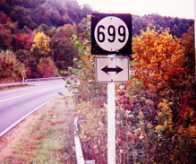
1994---VA 99 EAST , now within the Pulaski town maintenance jurisdiction, so it is no longer 699
|
1994---Another one of those reused small size markers at the VDOT yard in Dublin
|
1994---Leave Christiansburg town limits/enter Montgomery County. This was before the interchange 118A-B-C reconstruction on I-81
|
1996---VA F048 looking north from US 52/VA 42 at the west side of the I-77 junction near Bland
|
1992---Roanoke County near the BRP
|
1995----VA 8 SOUTH in Riner
|
1994---North of Dublin. VA 747 here is the old US 11. The 747 sign harkens back to the era of the whitewashed pyramid top timber posts & survived after being transfered to a newer post. (gone now)
|
1994---Here is another 18'' size old timer also transfered to a newer post outside New Castle
|
2001----Close up of a well preserved 18" size remnant in Big Stone Gap
|
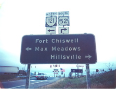
1994---Max Meadows, BEGIN VA 121 SOUTH
|
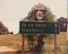
1992---Troutville
|
1992----Roanoke County east of Vinton
|
1992---North of Roanoke in Roanoke Co.
|
1992----These signs marked the town limit line of Troutville in Botetourt County. They were mounted perpendicular to the road, not facing traffic
|
1992
|
1992---Fincastle
|
1992---VA 816 near Daleville
|
1992---Botetourt Co. VA 640 at ???(can't recall)
|
1992---Right off I-81 exit 137, VA 112/VA 619 at frontage road
|
1994---Rural Retreat
|
another angle
|
1992---Roanoke County line
|
1992---This was visible during the winter months from I-81 northbound approaching exit 132 on a dead end. Fighting a few thorn bushes to get this shot proved a minor inconvenience
|
1992----VA 690 at VA 610 in Rockbridge County which at this time still had numerous old small non-reflective markers such as these. No pyramid top cut on this post though.
|
1992---At VA 658 in Roanoke Co.
|
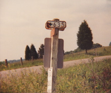
1992---VA 635 at VA 843, Franklin County
|
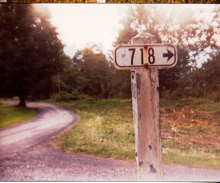
1992---At VA 635 in western Rockbridge County
|
1992---Fincastle
|
close up of v383
|
1992---US 11 NORTH, Rockbridge County
|
another view of v385
|
1994---Another view on old VA 57 in Martinsville
|
1992----Unusual to see a secondary route signed in the US & primary state style above a mileage sign with more than one destination.. Also note how an arrow takes the place of a distance less than 1 mile. Located off exit 156 of I-81
|
1994---VA 682 nearing VA 611 outside Dublin
|
1992---US 460 EAST/US 221 NORTH just before the routes split on the west side of Bedford
|
1994---VA 100 NORTH just north of Dublin. Older wayside signs were a non reflective dark blue background such as this.
|
1994---VA 1330 at VA 747 (old US 11) near Dublin
|
1993--VA 603 near the Ironto exit # 128 of I-81
|
1994---In Pulaski county, a simple delineator on the old official post
|
1994--VA 662 near Newbern in Pulaski Co.
|
1994---Rural Retreat
|
1994---VA 600 near Belspring, Pulaski Co.
|
1994----Hmmm, don't remember where
|
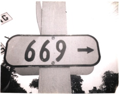
1993---Ya think?....VA 669 west of Riner, Montgomery Co.
|
1994---US 11 NORTH heading into Pulaski
|
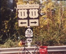
1992---VA 779 Roanoke County, also US BIKE ROUTE 76
|
1992---northeastern Roanoke Co.
|
1995---VA TECH grounds, making this VA 314, about to pass under US 460
|
1994---US 11 SOUTH Christiansburg
|
1992--VA 779 near Daleville
|
1994---VA 111 Christiansburg
|
1993---US 11, Pulaski
|
1993--US 11 NORTH/US 460 EAST about to head down Christiansburg Mountian
|
1994---town rd off VA 8 Christiansburg
|
1991---VA 115 in Roanoke
|
1993---US 460 BUSINESS WEST beyond the VA 111 junction in Christiansburg. The merge of US 460 BYPASS is ahead. This scene is much different now with a full freeway interchange
|
1992--- Along VA 779 and wherever you find this sign you're almost sure to find a pile of rubbish
|
1994---US 11 looking south on the west side of Wytheville. Does this mean I just provided undisputed proof of what a dangerous lawbreaker I really am?
|
1995---VA 624 just off US 11 near Fairlawn in Pulaski County
|
1996---Re-entering VA on US 460 EAST in Giles County(also former US 219)
|
1994---Not a traffic control device but it does have the old official post in green
|
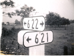
1999---VA 622
|
1994---VA 111
|
1994---US 11 NORTH leaving Radford
|
1994---Old US 11 entering Dublin (VA 747 south)
|
1993---"The Straightaway" as it's known in Elliston. US 11 SOUTH/US 460 WEST. If you magnify this shot you can see where someone turned the no parking sign into a smiley face parking sign
|
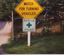
1993---Usually the green RESCUE SQUAD sign was accompanied by a red FIRE STATION sign but not here on the campus of VA Tech /VA 314
|
1993---Some of the lettering on this oldie had faded to the point of the green background showing thru
|
1994---Pulaski
|
1995---VA 611 SOUTH heading towards Pulaski
|
1993---VA 615 SOUTH, south of Christiansburg. Nothing wrong here, right?...or left?
|
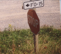
1994---No, it's not "Fo-fifteen", who put the hyphen on this one?
|
1994---Looking north on US 11 here which is actually more in a southerly direction crossing the New River on the old bridge into Radford
|
1993---Wytheville off I-77 exit 41, seems like an odd state sign, or city sign
|
1995---Wytheville Community College, VA 365
|
1994---Along the old section of US 11, frontage road F047, alongside I-81/US 11 in Pulaski County near the Wythe County line
|
1994---Usually they paint over the back of a reused sign but not here on VA 600 in Pulaski Co.
|
1994---Not many of these left
|
1992----A parking lot in Roanoke. Good 'ol kudzu.
|
1994---Scene along VA 600 at VA 612 in Pulaski Co.
|
1991
|
1994---Small embossed sign along the road to one of the Radford Army Ammunition Plant properties in Pulaski Co.
|
1994---US 11 SOUTH at JCT VA 90 ahead, near Rural Retreat
|
1994---When was the last time you saw one of these old type street light fiixtures?
|
1992
|
1994---I don't see a side street here, not even a hint of a driveway, do you? Maybe 50 years ago?
|
1994---VA F047, old VA 100 north appraching I-81/VA 100, exit 98, Dublin
|
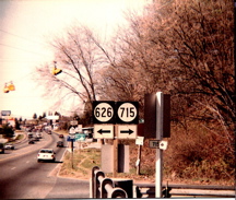
1994---US 11 SOUTH entering Pulaski County. A lot has changed here. With the construction of new dual bridges over the New River, the beacons are gone. So is VA 715
|
1994---VA 747 in Dublin
|
1992--Note the pointy decoration on the bottom of the right beacon in Salem
|
1992
|
1990---Roanoke
|
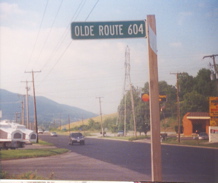
1992---"Olde" VA 604 approaching US 11 at Cloverdale
|
1995---Current 18'' size marker resembling the old all white style in Roanoke
|
1992----View looking straight up from VA 651 in Botetourt Co.
|
1992 or so
|
1991----Old syle 24" size after the I-581/US 220 interchange
|
1992----I sure misfocused this shot at US 460/US 11 ALT at VA 419 in Salem. And how about that "divider line" between the 81 & 419 shields? At least you can still see that
|
1991
|
1993---Pearisburg, BUSINESS US 460 EAST/VA 100 SOUTH, heading downtown and a familiar sight of someone standing by wondering why this weirdo is taking a picture of a road sign.
|
1991---Not often you'd see a side road with a MSS advisory sign. VA 24 EAST near the BRP
|
1978---I don't remember if this was after the state line or the first exit in VA, but it was the original way they did the interstate markings. The same black outline US or VA shields used on the BGS's were also used in this fashion as ground mounted confirmation or reassurance.
|
1992---VA 118 near the Roanoke Airport
|
1978---"I'd walk a mile for a small Virginia secondary route sign". Well actually, in this case I did, while the others were having dinner at the fast food, off exit (now)16 of I-64, I skipped eating to get this shot & get back in time before they left. Ah! the power of the VA secd. rtes.!
|
1978---On the walk back from the previous shot there was this one that got my eye
|
1977---First time I had seen signs embedded or painted or otherwise attached to the pavement on this bike path paralleling US 60 in Virginia Beach
|
1977---One of the towns along old US 13 on the Delmarva peninsula of VA
|
1977---Near Martin's Siding in Northampton County
|
1977---South side of Exmore, near US 13
|
1977----US 13 SOUTH, How did I get across with a bicycle? 6 hours hitchiking, 3 in the late afternoon, 3 more the next morning...
|
1977---US 13 SOUTH
|
1976---Not sure which exit off I-95, might be US 17 as I can only read "Fredricksburg" on the background sign. These were the first of the logo signs, note how small they started out compared to today
|
1976---I can't recall which exit this was either, somewhere along I-95 between the beltway & Fredricksburg
|
1976---In the opposite direction of the last photo
|
1976----A stop at the toll station allowed me to get this most excellent shot, dude!
|
1976----This one, off US 301, was for my state highway section which I never completed
|
1973----Back to the black & white polaroid film days. I-95 NORTH at the welcome center
|
1973---Somewhere along US 58 EAST out of Emporia
|
1973---Near Oyster in Northampton County
|
1971----Now here are the probable original styles, steel with an embossed border, numbers painted on the flat surface, and less of a rounded corner radius. This matched the style of the early US & VA embossed border cutouts with numbers only in the shield. Taken in Prince William County. These particular ones are backed with a piece of wood.
|
1971----Hanover County, the embossed border style with the all flat style
|
1969----VA 651 at 670, Fairfax County
|
1969- ---VA 644 at the beltway
|
1969---VA 644 at 611, Fairfax Co.
|
1969---Same intersection as v478
|
1969---VA 655 at 701, Fairfax Co.
|
1969---VA 670 at 832, Fairfax Co.
|
1969---Up close & personal
|
1969---Fairfax County, I-66 from the VA 655 overpass, I think this was looking west. I wonder how different it looks now?
|
1969---Intersection of US 29/50/211/VA 237. US 211 is no longer here
|
1969---Thanks to photo studio I was able to really improve this shot out the passenger window as we drove past.
|
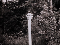
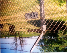
1969---Hanover County, VA 785 at 780
|
1969----Atlee, in southern Hanover County
|
1969----Louisa along US 33/VA 22
|
1969----Most likely in Prince William County, but the numbers on the county map don't correspond.
|
1969---Same thing here, I have this marked as 621 at 802, but it doesn't match up even though the numbers intersect.
|
1969---Hanover County VA 780 at 753, here again is the older embossed border style
|
1969----These next 4 are poor quality as they are from prints made from slides, but I'm sending them anyway....Not sure on this location
|
1969----Entering VA on US 301 SOUTH
|
1969---color shot of the same sign as on Adam's page
|
1969---about the best I could get this to come out
|
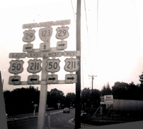
1969----US 50 EAST 2 left lanes US 29/211/VA 237 right lane
|
This is the best I could improve that last shot
|
1989---one of the 4 overlooked from 1989. US 52 NORTH
|
On the exit ramp of SOUTH US 52, the fading black paint around the shields shows their age here as originally all white backgrounds
|
along US 52
|
US 52 at the BRP |