Tennesseeand North Carolina
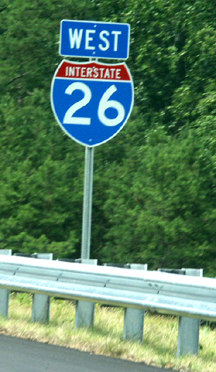
Westbound I-26
The first exit south of theUS 19/23 split is for NC 213 at Mars Hill. This photo is of the endof NC 213 at the US 19/23 expressway. The portion north of this exitis of recent construction, but as can be seen here, is not signed asI-26.
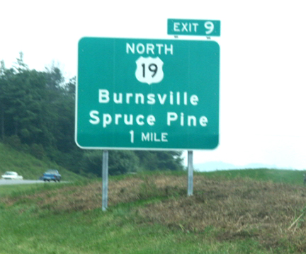
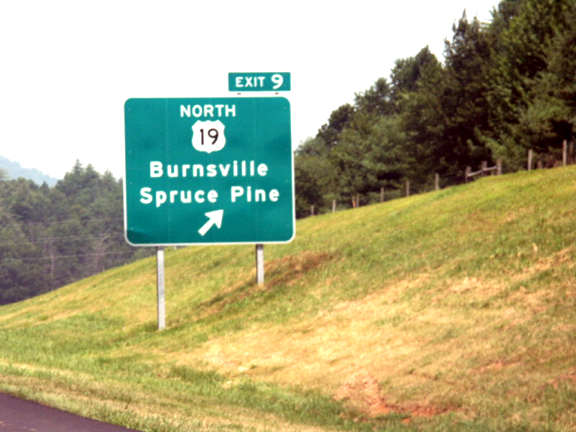
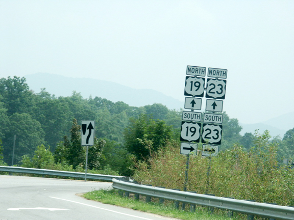
North Carolina maintains thatit will not sign US 23 along the I-26 route. The intent is for US 23to exit the freeway along with US 19 at Exit 9. However, exit signagein place at Exit 9 makes no mention of US 23. At this point, US 23simply seems to disappear, to be replaced by I-26.
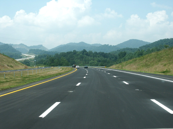
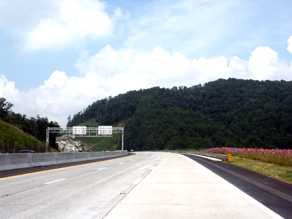
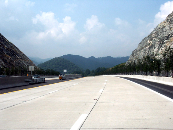
Just past the US 19 exit, thenew route begins its ascent to Buckner Gap, then beyond that, thestate line at Sams Gap.The first part of the route has an asphaltsurface and a cable median barrier. The route in the distance,climbing the mountain, has concrete pavement and a Jerseybarrier.
This is the first I-26 signposted north (west) of Exit 9. There is no mention of US23.
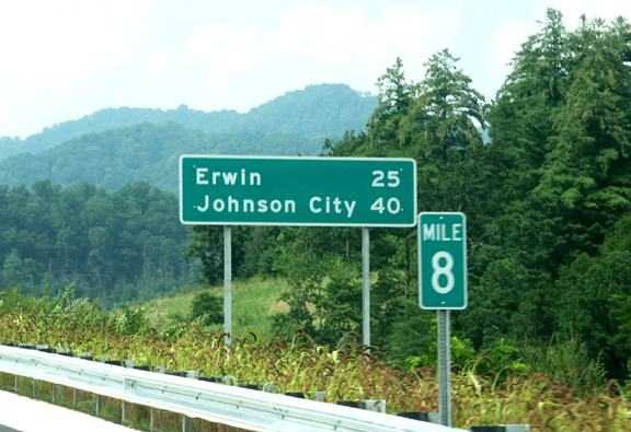
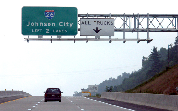
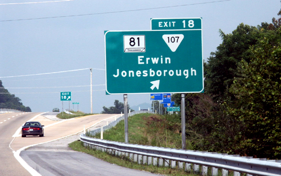
Eight miles from theTennessee state line, distances to Erwin and Johnson City areposted.

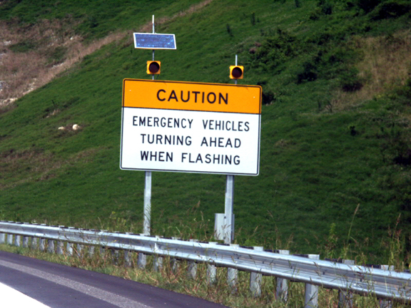
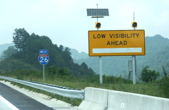
As the interstate begins itsclimb to Buckner Gap, a warning sign with a solar panel and anantenna stands ready to alert motorists to foggy conditions at thetop of the mountain.
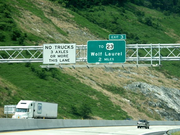
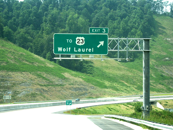
At the time of this photo,less than a week after the highway opened, trucks had alreadydiscovered the new route. This photo shows advance signage for Exit 3heading westbound; the truck is heading east out ofTennessee.
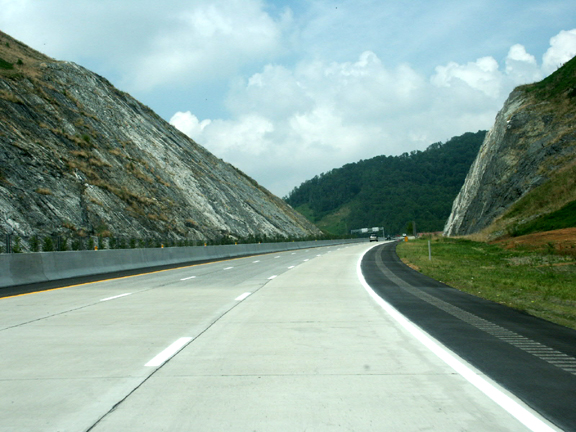
Climbing toward BucknerGap.
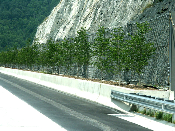
Nearing Buckner Gap, noticethe trees planted in front of the fence designed to catch fallingrocks. Also notice the asphalt shoulder with the grooved warningrumble strips, next to the concrete pavement.
The rest area wasn't the onlyplace to get a wildflower patch.
Just prior to the top ofBuckner Gap, there's a sign warning of the possibility of vehiclesturning around in the break in the Jersey barrier. There are onlythree opportunities to turn around on the new route -- the BucknerGap median break, Exit 3 and a median break at Sams Gap at the stateline.
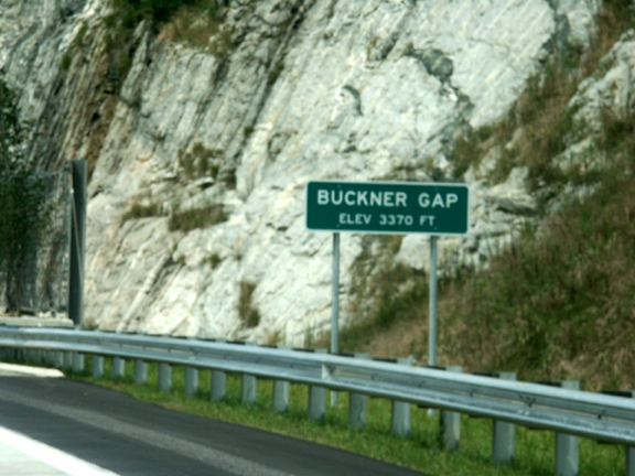
Signage at Buckner Gap.Notice the beginning of a rockfall retaining fence in the backgroundof this photo.
This photo shows the U-turnbreak in the median at Buckner Gap, along with the trees planted infront of the rockslide retaining fence -- not to mention a view ofthe distant mountains on a hazy August day.
Although US 23 disappearsfrom the route at the US 19 split, there is an opportunity to accessUS 23 at Bear Branch Road. If North Carolina insists on keeping theUS 23 designation on the new route, and if Tennessee insists onkeeping US 23 on the freeway (which I feel is the proper decision)then a good compromise would be to keep US 23 on the North Carolinaportion of the freeway to this point. Heading west on I-26, this isthe spot where the freeway would pick up US 23 again.
Just past the Bear Branchexit, the final standalone I-26 sign in North Carolina is locatedjust beyond another fog warning sign. What does the white platecover, I wonder?
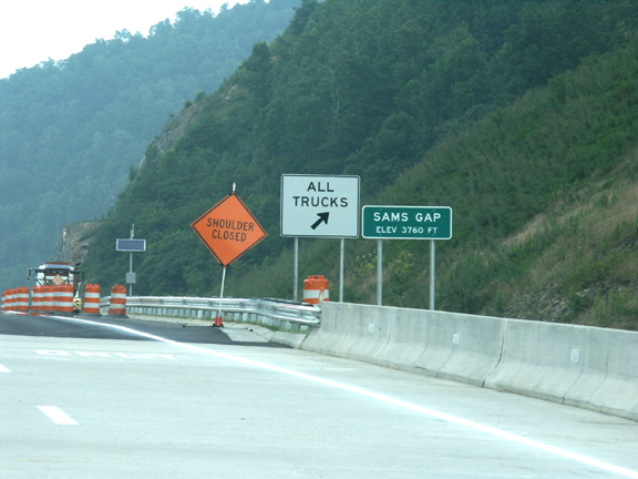
The new North Carolinaportion of the freeway is three lanes. Here, the route approaches theTennessee state line at Sams Gap. The two left lanes continue as thethrough I-26 and US 23 route; the right lane is an exit-only lane forTennessee's truck information station and mandatory stop for thedownhill grade into the Volunteer State. This is the last I-26 signin North Carolina.
There is no state line signhere -- the old "Welcome To Tennessee" guide sign must have been avictim of the construction -- but this is the state line as seen fromthe bridge over old US 23 at Sams Gap. The Tennessee truck mandatorypulloff area was closed for incidental construction that remained tobe finished after the highway opened.
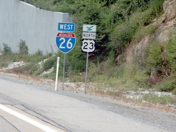
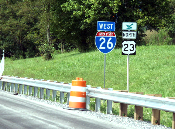
The first I-26 sign inTennessee, just past the state line as the road begins its downhilldescent, is placed alongside a US 23 sign. This is evidence ofTennessee's decision (so far) to keep US 23 on thefreeway.
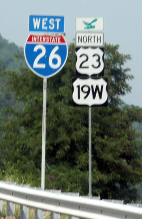
This is the first assemblyshowing the combined I-26 and US 19W/23 routing, north ofErnestville.
This exit at Erwin is unusualbecause it is the intersection of all four types of signed routes inTennessee -- Interstate, U.S. route, state primary and statesecondary. Unfortunately there are no sign assemblies showing allfour types of signs on the same post.
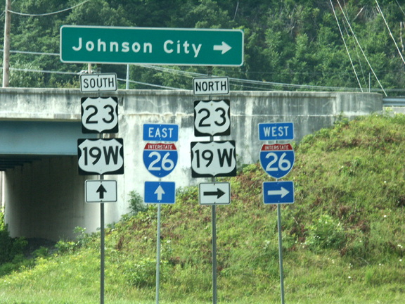
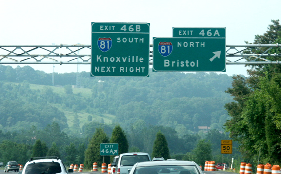
In Johnson City, US 19Wsplits from the route and follows US 11E to the spot where US 19Ejoins to re-form US 19, just south of Bristol.
This is the last I-26 sign inTennessee. It's posted just north of the Eastern Star Road exit. Aconstruction barrel from a summer paving project isvisible.
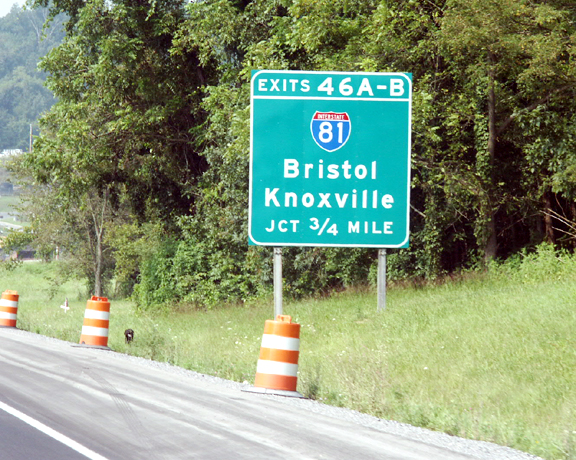
The signage at I-81 gives noindication that I-26 ends and I-181 begins.
StartTour Over Again• Backto the Millennium Highway Roads Page