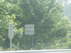
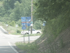
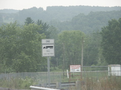
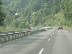
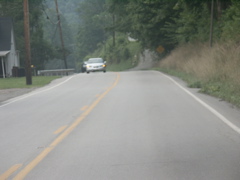
This old style text "Do Not Enter" sign is located on the Mountain Parkway at Exit 57. It faces eastbound traffic on the two-lane route and warns traffic not to enter the exit ramp from KY 191 and KY 205 to the westbound parkway. This is an old-style sign that does not have reflective sheeting and is probably 30 years old or older.
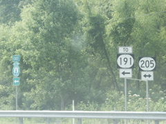
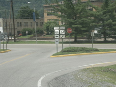
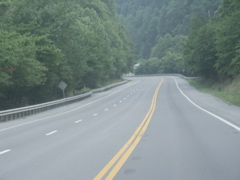
This signage is visible when you leave the Mountain Parkway at Exit 57. KY 205 crosses under the parkway and immediately intersects KY 191.
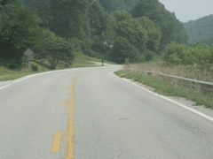
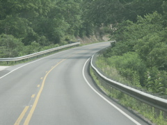
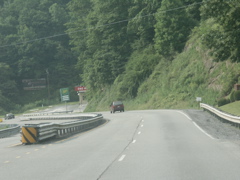
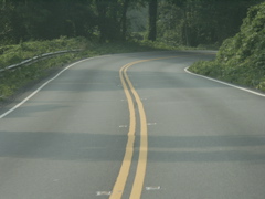
This is looking north on KY 205 and west (formerly south) on KY 191. Immediately ahead is the on-ramp to the westbound Mountain Parkway.
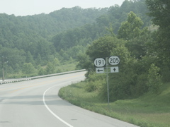
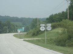
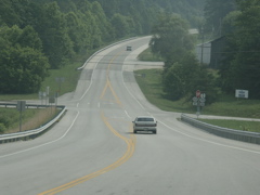
This is where KY 191 splits from KY 205.
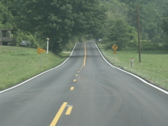
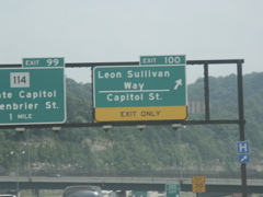
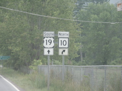
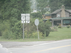
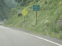
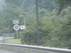
Looking north on KY 205 at the intersection with KY 705, which is the old alignment of KY 205.
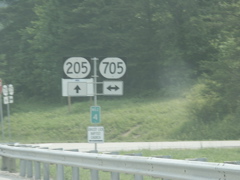
KY 205 and KY 705 signage.
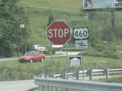
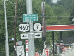
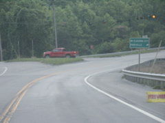
The end of KY 205 at US 460.
US 460 has traffic islands at the KY 205 intersection, hence the "divided highway" arrow in the previous photo. This shows the perspective from eastbound US 460 as the highway narrows back down to two-way traffic.
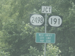
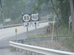
Approaching KY 191 and KY 2498 at Index, which has now been annexed (or indexed, if you prefer) into the city limits of West Liberty.
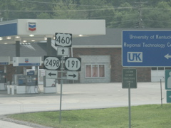
Intersection of US 460, KY 191 and KY 2498.
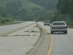
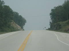
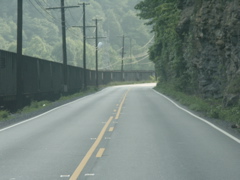
Looking down the hill on US 460 at the Licking River bridge in the distance. This portion of US 460 has been three-lanes for 30 years or longer.
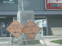
Prestonsburg Street is US 460 east and KY 7 south heading out of West Liberty. The street in front of the Morgan County courthouse is often closed for events, such as a July 4 concert, so the city has already had ready-made detour signs made up guiding drivers to the routes they want to take.
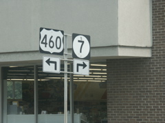
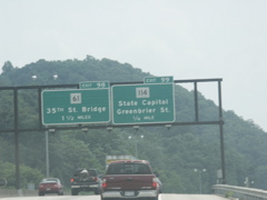
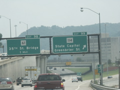
This is looking west on US 460, north on US 7, at the advance signage for the split in the routes. The routes run together from Salyersville to West Liberty.
Split of US 460 and KY 7.
This is the beginning of the new portion of KY 7 north of West Liberty, which opened in December 2005.
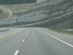
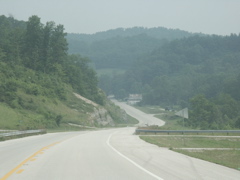
Another shot of the three-lane roadway and the massive rock cuts.
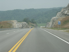
Looking down the hill toward Elk Lick Creek and the KY 519 intersection.
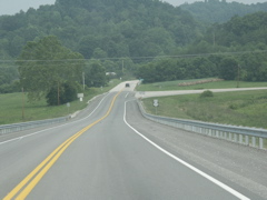
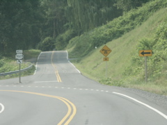
Looking ahead at the beginning of KY 519, which goes straight ahead to Morehead. KY 7 veers to the right.
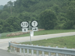
Signage at the beginning of KY 519.
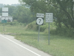
North KY 7 signage after the split.
A view of old KY 7 north of KY 519.
This portion of KY 7 recently received new pavement.
Looking at the top of Wrigley Hill on KY 7, an improved portion that opened in 2001
Looking north on KY 7, descending Wrigley Hill and looking toward KY 711 and the community of Wrigley.
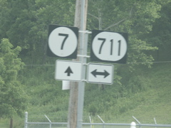
KY 7 and KY 711 signage.
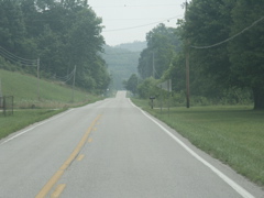
This straight stretch on KY 7 north of Wrigley is more than a mile long.
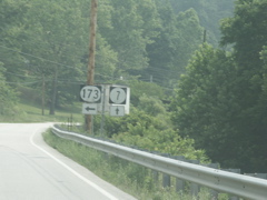
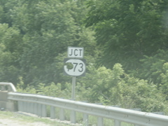
Intersection of KY 7 and KY 173 in southern Elliott County. Prior to the opening of new KY 519 in the 1980s, KY 173 was the best route from West Liberty to Morehead.
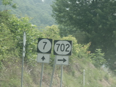
KY 7 and KY 702 signage.
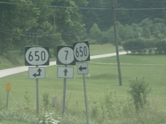
KY 650 joins KY 7 for a short distance. The sign on the right is what motorists on KY 650 see when they arrive at KY 7.
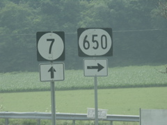
KY 650 departs KY 7.
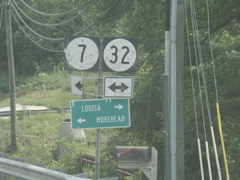
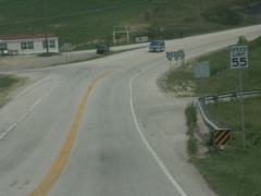
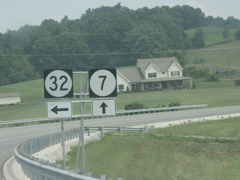
Looking down the hill at Sandy Hook at the intersection of KY 7 and KY 32. At one time the intersection was controlled by a traffic light but the light was removed back in the early 1970s. Elliott County is one of the few in Kentucky without a traffic signal. Others in the region are Owsley and Menifee counties.
Signage where KY 7 joins KY 32.
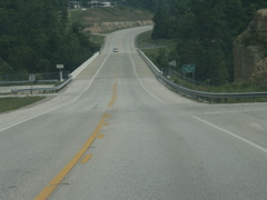
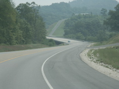
Looking toward the beginning of an improved KY 7/KY 32 north of Sandy Hook. The intersection in the distance is KY 557.
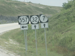
KY 557, KY 32 and KY 7 signage.
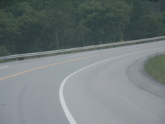
View of the new Laurel Gorge Bridge on KY 7. This bridge replaced an old truss bridge at the floor of the gorge, and the highway replaced a very curvy section of KY 7.
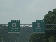
New construction on KY 7 where KY 32 departs for Morehead.
KY 32 and KY 7 signage at the split.
Looking north on KY 7, past the new state prison, at a bridge crossing the Little Sandy River at the southernmost fringes of Grayson Lake. This bridge replaced an old narrow steel truss bridge and opened in 2005.
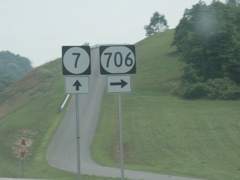
KY 7 and KY 706 intersect at the northern end of the bridge seen in the previous photo.
This is where new KY 7 ends and transitions to the old alignment past KY 706. The house on the right will no doubt be a victim of future expansion of the roadway, judging from the alignment of the proposed extension at right.
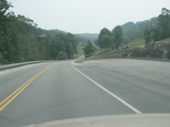
Typical view of KY 7 in Elliott County approaching the Carter County line.
Crossing an arm of Grayson Lake into Carter County. The county line sign has been down for years and not replaced.
Crossing the dam at Grayson Lake.
For a period, Kentucky used some sort of plastic or fiberglas for some of its signs. This KY 773 sign shows how fragile the material was. It has a big gaping hole. This sign has been this way for at least six years.
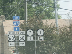
Signage where KY 7 meets US 60 and KY 1 in Grayson.
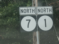
KY 7 and KY 1 signage (extreme closeup) past US 60.
Approaching I-64 on KY 7 and KY 1
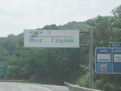
This "Welcome to West Virginia" sign has not been changed to the new style. However, there is no governor's name. On I-64 eastbound.
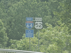
First I-64 sign in West Virginia is joined by US 52 and an "Eisenhower Interstate System" logo sign.
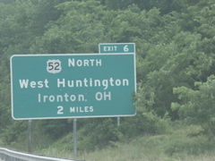
On ths sign, the old second line of "Chesapeake, OH" which was in button copy, has been replaced by "Ironton, OH" in non-button copy lettering.
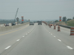
Construction where the new US 35 will tie into I-64.
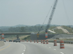
Work on the new bridge which will carry US 35 over I-64.
Approaching the US 35 exit on eastbound I-64. I have taken photos of this sign before but just figured out that it's a roadsignmath.com winner. You take the numbers, do the math, and see what you come up with.
Although the camera did not catch it very well, this sign was one of the brightest shades of yellow I have ever seen on a highway sign.
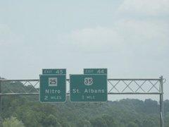
Two separate exits for WV 25 are approaching.
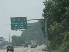
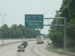
Signage as I-64 prepares to cross the Kanawha River yet again.
Drawing closer to downtown Charleston and yet another Kanawha crossing.
Advance junction signage for I-64 and I-77, with I-79 thrown in for good measure.
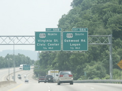
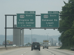
More advance signage for the US 119 exit that marks the northern end of ARC Corridor G.
Another advance sign for the interstate intersection in Charleston.
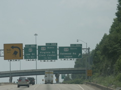
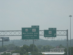
Signs for all three ramps that constitute Exit 58 in Charleston. I have previously photographed this assembly with the old button-copy signs that were here.
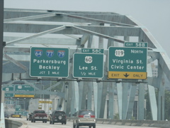
Signage as I-64 prepares to cross the Kanawha River into downtown Charleston.
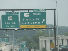
Exit 58B and C.
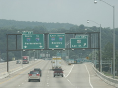
Exit 58C with lane designations for the I-77 interchange.
Lane designations for I-64 and I-77.
The I-64 ramp to I-77.
Arrow signage at the exit gore point.
Now on I-77 south.
Oops, the left sign got cut off.
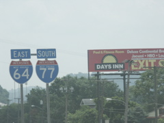
I-64 and I-77 state name signage.
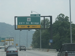
Exits 99 and 98.
At Exit 99.
Exit 98 features a lane drop.
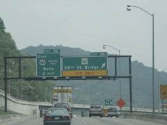
Exit 98 with the upcoming US 60 exit.
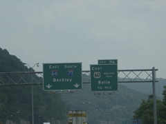
US 60 joins the interstate briefly before quickly departing.
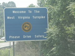
Welcome to the West Virginia Turnpike.
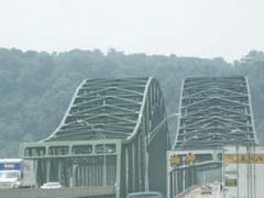
Crossing the Kanawha yet again.
After the river crossing is this exit for WV 61.
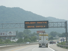
This variable message sign carried a holiday warning for the Fourth of July.
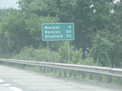
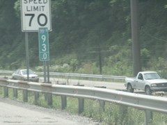
Mileage sign on the WV Turnpike southbound.
This is the new style of mile marker that has been installed on the interstates in the Charleston area.
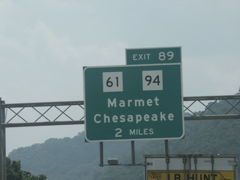
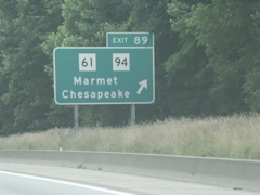
Approaching Exit 89.
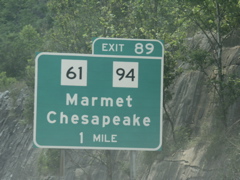
One-mile signage for Exit 89.
Signage at the exit for WV 94, which promptly ends at WV 61.
Two-mile sign for the exit that connects the interstate to the Admiral T.J. Lopez bridge, which crosses the Kanawha River and connects WV 61 with US 60.
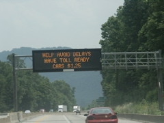
This VMS cautioned drivers about the toll booth that lies ahead on the WV Turnpike.
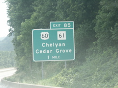
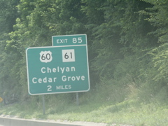
One-mile exit signage for Exit 85.
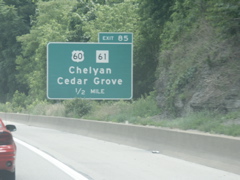
Half-mile signage for Exit 85.
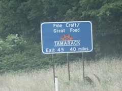
Sorry, we won't be going to Tamarack on this trip.
Exit 85 signage.
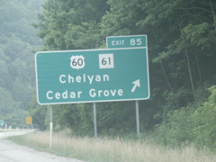
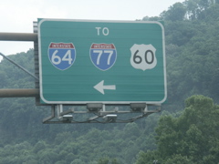
Guide signs for WV 61 and US 60 traffic on the approach to the Lopez Bridge.
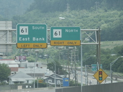
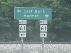
The turn for the ramp to WV 61. Why is it called East Bank when actually it's on the west bank of the Kanawha?
Looking down the ramp from the bridge access road to WV 61.
At the end of the ramp from the Lopez Bridge.
This sign points drivers on southbound WV 61 to the bridge.
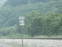
South WV 61 sign.
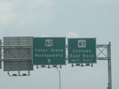
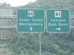
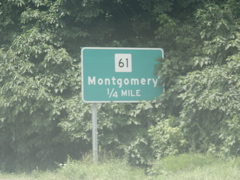
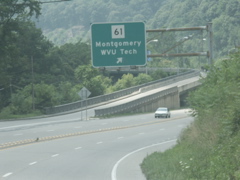
These signs point to the WV Turnpike at Paint Creek Road, north of Montgomery.
This is the end of unsigned WV 6 as seen from southbound WV 61. WV 6 links WV 61 in Montgomery with US 60 in Smithers and constitutes a Kanawha River bridge.
Looking at the bridge that carries WV 6 across the Kanawha River.
The end of WV 6 at the ramps to US 60 east or west.
This is where the ramp to eastbound US 60 merges with the ramp. On the left is the ramp from westbound 60 to WV 6.
This is the signage on westbound US 60 for the WV 6 ramp. WV 61, not WV 6, is posted.
Overhead signage at the beginning of WV 6 also posts WV 61.
The ramp to WV 6 with the overpass of WV 6 across US 60 in the background.

Signage on the bridge approaching the loop to WV 61.
The end of WV 6 at WV 61.
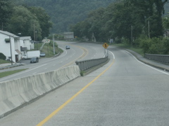
Mileage sign on WV 61 beyond Montgomery.
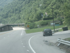
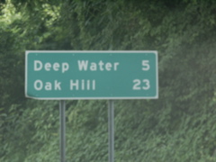
Typical view of WV 61 in the Kincaid and Page area, between Deep Water and Oak Hill.
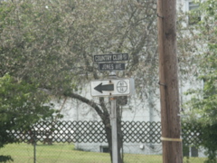
Very old County 61/16 sign located on WV 61 (Jones Avenue) in Oak Hill. This view is looking north on WV 61 back towards Montgomery and Deep Water.
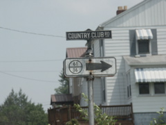
The other side of the sign previously pictured, looking toward the WV 16 intersection in Oak Hill.
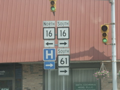
WV 61 meets WV 16 in Oak Hill.
At least the routes are going in the same direction. If this was a "wrong-way multiplex" then dyslexics would really be confused.
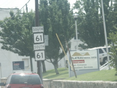
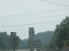
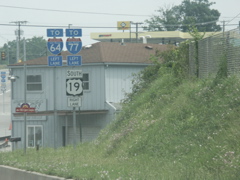
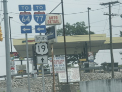
WV 16 and WV 61 transition to a ramp to southbound US 19.
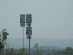
WV 16 and WV 61 immediately split from US 19 upon joining the route.
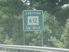
Junction signage for WV 612, which provides a cutoff from US 19 to the West Virginia Turnpike.
Approaching the departure of US 19 from the Corridor L freeway.

One-half mile exit signage for the departure of US 19 from the Corridor L four-lane.

Overhead signage at the ramp carrying US 19 off Corridor L.
Signage at the end of the ramp.
Going back under the bridge, this sign directs traffic to US 19 north.
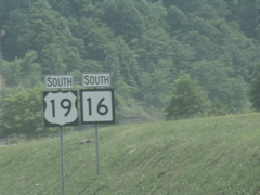
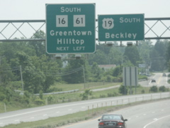
US 19 and US 16 signage.
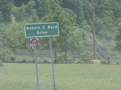
What a surprise! Something in West Virginia named for ol' Bobby KKK Byrd!
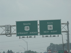
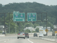
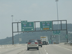
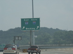
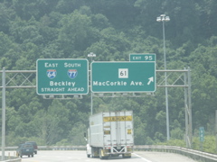
Overheads for split of US 19 and WV 16 in Beckley.
I-64 trailblazer accompanies US 19 signage past the WV 16 split.
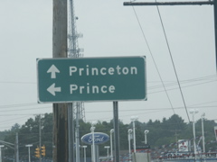
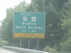
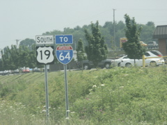
At the US 19 and WV 41 intersection -- interesting, to say the least, Princeton and Prince.

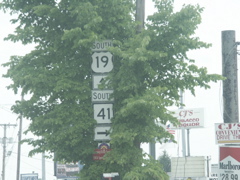
US 19 joins WV 41, which is the old routing of the US highway.
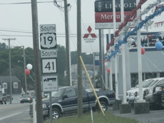
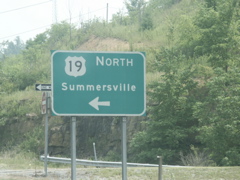
US 19 and US 41, last seen together several miles north in Summersville, are back in tandem again.
Split of US 19 and WV 41, obscured by a tree.
Signage approaching the connector to I-64.
Signage at the connector.
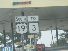
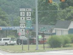
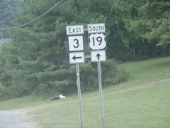
US 19 and WV 3 markers.
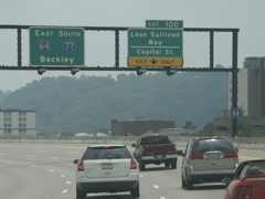
This shot shows overheads on the connector route that leads to I-64. Portions of this route are under construction as an East Beckley bypass that will eventually link to Corridor L north of town.
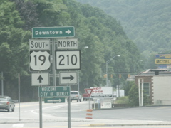
US 19 and WV 210 signage.
WV 3 meets US 19.
I-64 overpass above US 19 and WV 3.
WV 307 intersects US 19 and WV 3.
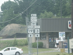
You aren't seeing double -- WV 307 loops around and rejoins US 19/WV 3 a few miles further south.
WV 3 splits from US 19 at Shady Spring.
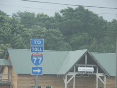
This sign directs motorists to the WV Turnpike near the Homeplace Ski Resort at Ghent.

A bit further south, at Camp Creek, US 19 intersects I-77 again.
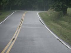
Typical view of US 19 near Spanishburg, after a pouring rainstorm.
WV's truck reporting program ends on US 19 approaching WV 10.
Advance signage for WV 10.
This represents the southern terminus of WV 10.
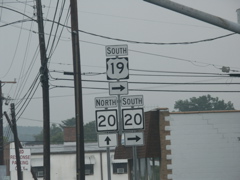
US 19 and WV 20 intersect in Princeton.
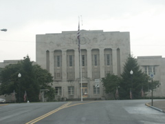
US 19 and WV 20 go around the Mercer County Courthouse in downtown Princeton.
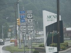
US 19 and WV 104 intersect just south of downtown.
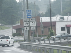
After a short combination, WV 104 departs US 19.
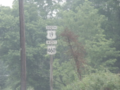
Old button copy sign at the intersecton of US 19 and US 460.
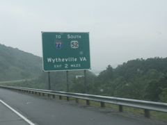
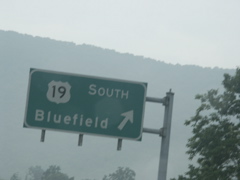
This sign now lists only US 52 south, because the interchange is not fully completed. Once the extension of US 52 (the King Coal Highway) is completed north of Bluefield, the "South" should be removed.
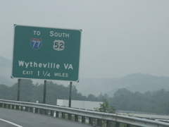
Drawing closer to the new US 52 interchange. There is space between the route markers and the "Wytheville" text to add a city name, probably Welch if not Williamson.
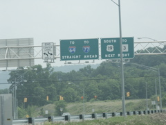
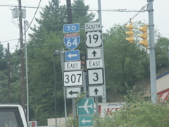
US 460 and US 19 signs as the two routes draw closer to their split.
Overheads approaching the split of US 460 and US 19.
Overhead directional sign for US 19.
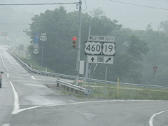
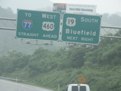
Ground-level signs at the split with I-77 and Truck US 52 signage in the background.

South US 19 and North Truck US 52 signs after US 19 leaves US 460 and passes the WV 112 intersection.
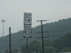
Wrong-way shared route of South US 19 and North US 52 in Bluefield.
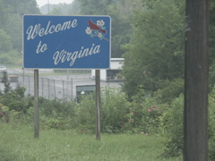
Entering Virginia on US 19.
Immediately upon entering Virginia, drivers heading south on US 19 are presented with a set of cutouts for both US 19 and US 460.
Another set of cutouts. This is the third and final set of cutouts as you head south on US 19. Several years ago there were more than two dozen sets of cutouts in Bluefield but most of them have been removed and replaced with modern markers.
US 19, US 460 and unusual-shaped VA 102 cutout signs in downtown Bluefield.
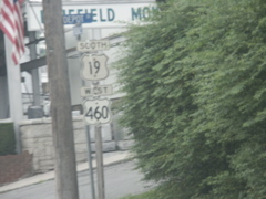
US 19 and US 460 signs in Bluefield.
US 19, US 460 and another odd-shaped modern VA 102 cutout.
Odd use of an advance turn arrow under these two signs.
Even though US 460 no longer runs through Bluefield, it is fully posted on the Virginia side. These signs in the southern part of Bluefield (a/k/a Graham) have replaced the many sets of cutouts that used to be present here.
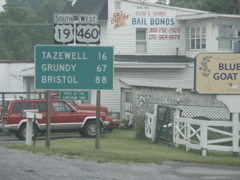
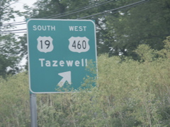
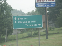
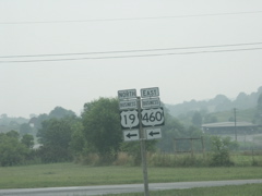
Leaving Bluefield, US 460 is still posted with US 19. Both routes go to (or by, more precisely) Tazewell. US 460 heads to Grundy; US 19 to Bristol.
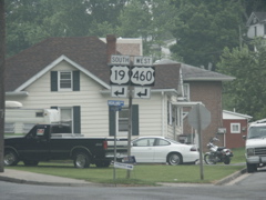
Approaching the intersection where US 19 rejoins US 460.
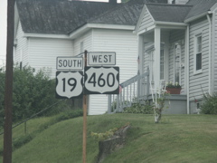
Closeup of the leftmost sign in the previous photo.
Closeup of the rightmost sign from two photos ago.
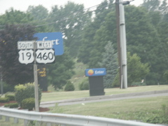
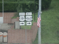
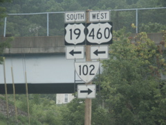
First US 19 and US 460 signs posted after the routes rejoin. Notice no standard mileage sign beneath them.
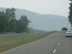
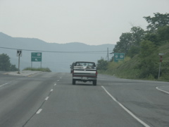
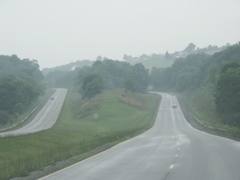
Typical view of the four-lane highway south of Bluefield.
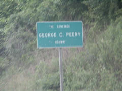
US 460, also known as Appalachian Corridor Q, is known as the Gov. George C. Peery Highway. That's Peery, not Perry, so this is not a misspelling.
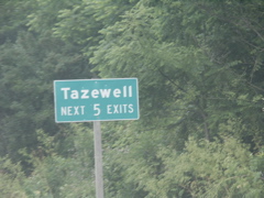
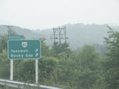
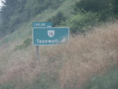
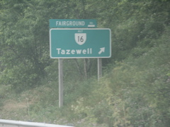
Lots of access to Tazewell, although US 19/460 bypasses the city to the west.
Signage nearing the split of the US 19/460 business route from the four-lane.
Past the split, this is the view of the Tazewell bypass.
US 19/460 intersects VA 61.
The next exit is for VA 16.
And then there is Alt. VA 16. The "ALT" is nearly too small to read.
Finally, the business routes for US 19 and US 460 rejoin the mainline.
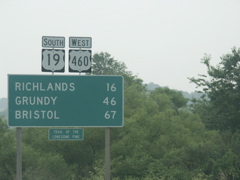
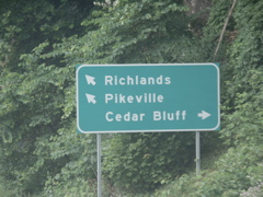
Past Tazewell, Richlands is the next major town. It -- or more precisely, Claypool Hill -- is where US 19 and US 460 split.
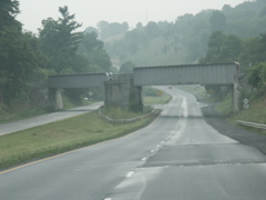
A railroad underpass between Tazewell and Claypool Hill.
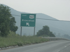
As US 460 prepares to split from US 19, destination signs begin popping up.
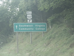
While US 460 (Corridor Q) turns right, you continue straight on US 19 to get to SWVACC.
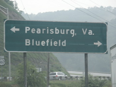
Just so you'll know, Pikeville is in Kentucky. Just as Bristol can be considered the "control city" for US 19, Pikeville is for US 460.
US 460 departs US 19.
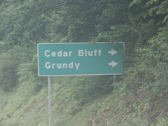
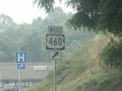
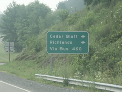
Approaching the US 460 business route through Cedar Bluff and Richlands, this is the sign.
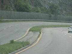
Typical section of the US 460 bypass of Richlands.
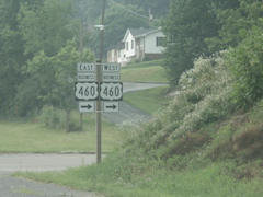
US 460 intersects the business route at a spot where the two highways are parallel and adjacent to each other.
You can turn one way and go in two directions, according to this sign at least.

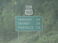
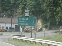
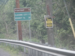
The first mileage sign on US 460 after the split from US 19 shows the distance to Grundy, the next (and last) major town in Virginia past Richlands, and Pikeville, where US 460 meets US 23 and US 119 at a hub of Appalachian Regional Commission corridors.
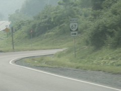
VA 67 intersects US 460 along the Richlands Bypass.
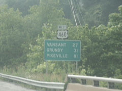
Vansant is a small town outside Grundy, which along with Pikeville is still highlighted on US 460's mileage signs.
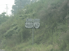
US 460 and VA 67 join briefly outside Richlands.
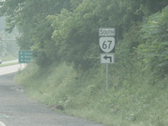
VA 67 departs as US 460 prepares for a hill climb to the Buchanan County line.
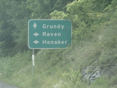
VA 67 takes you to Raven and Honaker.
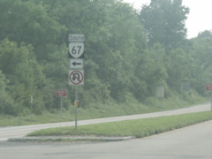
Signage at the turn for VA 67.
US 460 and another mileage sign. Even when I get to PIkeville it will still be another 100 miles on to home for me.
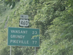
Well, we're one mile closer than we were in the last photo.
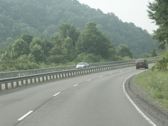
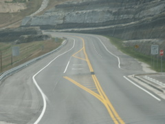
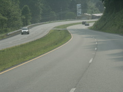
Typical section of US 460 as the four-lane route climbs toward the Tazewell/Buchanan county line.
Another photo showing the road's tight curves and lack of shoulder.
Crossing into Buchanan County at the top of the hill at Shortt (yes, with two "t's") Gap.
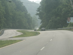
Heading down the mountain on US 460.
Still going down.
As the road approaches the bottom of the mountain, the median widens out.
The highway is still curvy, however.
Drawing closer to Grundy but Pikeville's still a good hour away.
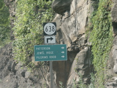
VA Secondary 638 leads to several local destinationsl
Approaching VA 83 at Vansant, outside of Grundy.
VA 83 goes to Haysi, Clintwood and finally Pound.

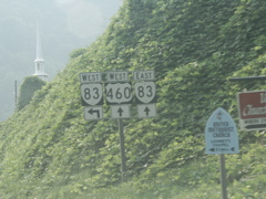
Intersection of VA 83 and US 460.
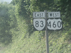
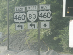
Going both east and west at the same time.
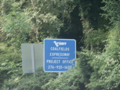
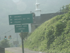
No big US 121 sign here, like in West Virginia, but the office for the Coalfields Expressway project still has official signs.
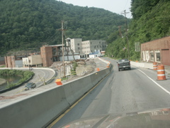
This is a view of the demolition of several buildings in downtown Grundy. Much of the town is being relocated out of the flood plain in a project that will also expand US 460, Corridor Q, in this area.
If you are heading west on US 460, this is where eastbound Va 83 departs. However, due to the one-way street setup, VA 83 traffic must continue straight at this intersection (from right to left).
Westbound VA 83 approaches the intersection where it joins the other one-way couplet of US 460.
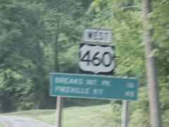
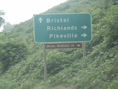
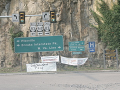
Got some motion blur here, but this sign heading out of Grundy reads "Breaks Int. Pk. 16, Pikeville Ky. 48." Not sure why the state name is listed after Pikeville here when it hadn't been on previous signs.
Typical view of the two-lane US 460 west of Grundy.
US 460 is wedged between a rock cut and a railroad track.
VA Secondary 700 continues straight, US 460 makes a left and crosses the railroad tracks and the Tug Fork of the Big Sandy River.
This is the Kentucky state line, as noted byt he pavement change. A green "Kentucky State Line" sign can be seen at left and in the distance, a blue "Welcome to Kentucky" sign is partially visible.
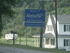
The blue sign previously mentioned.
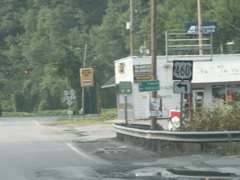
US 460 prepares to make a left turn at the intersection with KY 1499. KY 1499 is the former routing of US 460 prior to the construction of Fishtrap Lake.
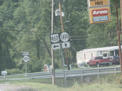
US 460 and KY 1499 signage.
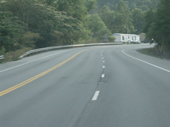
This is the relocated routing of US 460 made necessary by the construction of Fishtrap Lake. The route crosses two mountains between Mouthcard and Belcher and is certainly more modern than the route it replaced, as evidenced by the passing lane and the wide shoulders.
Heading down the mountain, with a truck lane in the opposite direction.
The relocation of US 460 placed it on the alignment of KY 80 from Belcher to Shelbiana.
Intersection of US 460 and KY 80.
Signage at the KY 80-US 460 intersection.
Typical view of US 460/KY 80. This is near Draffin.
A few spots along the route have been improved, as evidenced by the smooth curve and wide shoulder.
This rock cut is part of an improvement that bypassed an older bridge and eliminated a T intersection where westbound traffic had to stop at what was the old alignment of US 460 prior to the impoundment of Fishtrap Lake.
This sign is looking back east on US 460/KY 80 just past the point where the routes split from US 23/119.
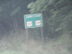
Approaching darkness and a major thunderstorm caused some motion blur on this photo, but it is of new signage as US 460/KY 80 westbound approach US 23/119. The US route signs have black outlines. This looks like something that would be posted in Virginia.
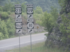
US 460 and KY 80 join US 23/119.
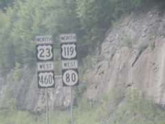
Together, the four routes head toward Pikeville.
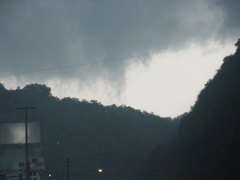
Doesn't this sky look ominous? At the time it was taken, nearly 7 p.m. on July 4, a thunderstorm was rolling across Pikeville. This photo was taken looking to the northeast, near the point where US 119 splits from US 23/460 and KY 80.